filmov
tv
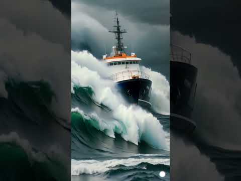
What is the Northern Sea Route? 🌏

Показать описание
What is the Northern Sea Route? 🌏
As ice recedes a new shipping route is opening up in the Arctic 🧊
This new route could represent attractive time and fuel cost savings for shipping companies 💰
#NorthernSeaRoute #NSR #Arctic #ArcticGeopolitics #Future #SuezCanal #Geopolitics
---------------------------------------------------------------------------------------------------------------------------
👍 Support our work here:
☕ Buy us a coffee:
📺 Follow us On Odysee:
💼 Business email:
☑️ Please like, comment and subscribe!
Thank you for watching!
---------------------------------------------------------------------------------------------------------------------------
For centuries ships have mainly travelled from East Asia to Europe through one of two routes. The first being through the Indian Ocean and around the Cape of Good Hope, and the second and more recent, through the Indian Ocean, Red Sea and Suez Canal.
However, as average global temperatures continue to rise and Artic Sea ice recedes further, a third route is now opening up, this being the Northern Sea Route through the Bering Strait, the seas of the Arctic Ocean.
For the sake of comparison, were a ship to travel from Japan to the Netherlands via the Northern Sea Route the distance would be less than 9000 kilometres, whereas the route through the Red Sea and Suez Canal would be a distance of roughly 20,000 kilometers. Therefore, the shortcut through the NSR represents an attractive saving in time and fuel costs for many shipping companies.
The viability of the Northern Sea Route has been called into question by some experts, however, who cite issues such as a lack of infrastructure along Arctic Coastlines and weather conditions as major issues.
 0:06:27
Why Is The North Sea So Scary And Dangerous?
 0:12:49
The North Sea explained
 0:00:21
The North Sea Is Scary! 😱
 0:00:16
The Burning North Sea 😱😱 As Created By Ai
 0:01:00
Why TF Is the North Sea Terrifying? #northsea
 0:00:24
10,000 $ Per Month To Work At North Sea #northsea #waves #ship
 0:00:15
The North Sea Is Scary 😱 Pt 4
 0:00:29
North Sea has the darkest night on Earth #shorts
 0:00:36
Dangerous Anchor Drop | The North Sea #northsea #ocean #anchor #ship
 0:00:40
‘The North Sea Isnt That Bad, Is It?’ #shorts
 0:00:24
North Sea frozen ice hammering #northsea #frozen #ship
 0:00:19
The precious North Sea as imagine by ai
 0:01:00
The Strom North Sea #northsea #waves #ship
 0:04:49
What is the Northern Sea Route and how important is it for India? | The Hindu
 0:00:28
Life at the North Sea #northsea #waves #ship
 0:01:00
Would You Take The Job? 🌊😳 #northsea #ocean #scary #shorts
 0:00:19
The Fear Of The North Sea As imagine by ai
 0:02:07
The North Sea 🌊😱 Most Dangerous Sea In The World 😰 #scary
 0:00:52
The last clip will truly shock you 😱😱 #northsea #ocean #sea #adventure #shorts
 0:00:48
25,000 $ Per Month Job at North Sea. Would you like this job ? #welding #oilrig #northsea
 0:00:56
What Happened on the Viking Sky?
 0:10:35
The Most Dangerous North Sea: Why Monster Waves in the North Sea Can Sink Giant Ships
 0:01:01
THE NORTH SEA IS SCARY #shorts
 0:00:54
The North Sea Is Scary! 😱 Pt 11
Комментарии