filmov
tv
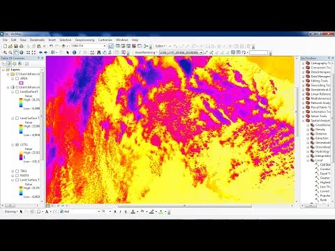
Calculating Land Surface Temperature Using Landsat 8 Imagery In ArcGIS || The GIS Hub || #LST #gis

Показать описание
The radiative skin temperature of the land that results from solar radiation is known as land surface temperature (LST). The land surface where the incoming solar energy interacts with and warms the ground or the surface of the canopy in vegetated regions is where LST detects the emission of thermal radiation.
In this video, we will learn how to estimate land surface temperature using Landsat 8 imagery in ArcGIS. The data can be downloaded from the USGS website.
How To Download Landsat-8 Satellite Imagery For Free:
If you want the document in the video, please provide your email in the comment. I will send you in the mail.
------------------------- My Other Videos ---------------------------------
Do watch my other videos:
Top 10 GIS Software Applications In 2022
How To Create A Contour Using DEM Data
How To Create A Covid-19 Map Using QGIS
Supervised Classification Using ArcGIS:
How To Create A Map With OSM Data Using QGIS:
How to Create A Choropleth Map Using Leaflet:
Create A Map Layer Using Leaflet:
Add A Marker To The Map Layer:
Use Different Map Tile Layer In Leaflet:
Add Google Map To Your Website:
Layer Group And Control In Leaflet:
Add Shapefile in leaflet:
How to add GeoJSON File in leaflet:
#Landsurfacetemperature #LST #GIS #arcgis #landsat #RemoteSensing #Satellite_Imagery #NASA #Landsat #arcgistutorial #QGIS
Keywords: land surface temperature, LST, GIS, GIS and remote sensing, arcgis tutorial, arcgis, landsat-9, imagery, satellite, qgis, ArcGIS, gis, remote sensing, NASA
Remote sensing, arcgis, GIS youtube channel, geospatial science, LST Calculation, Land surface temperature calculation by Landsat 5 and 7, Calculation of Land surface temperature, LST measurement, Land surface temperature measurement, LST,Landsat 5, Landsat 7, Landsat 8, Land surface temperature calculation, how to calculate Land surface temperature, how to measurement LST, how to measurement Land surface temperature, How to calculate Land surface temperature of Landsat 8 Imagery
 0:10:46
Estimating Land Surface Temperature Landsat 8 | ArcGIS Tutorial |
 0:26:43
How to calculate land surface temperature from Landsat 8 Satellite Data
 0:17:46
Calculating Land Surface Temperature Using Landsat 8 Imagery In ArcGIS || The GIS Hub || #LST #gis
 0:06:39
Calculating Land surface temperature using Landsat 8 Imagery || QGIS Tutorial
 0:07:36
Calculating Land Surface Temperature (LST) of Landsat 7 and Landsat 5 | ArcGIS Tutorial
 0:26:31
Estimating the Land Surface Temperature (LST) using Landsat 8 in ArcGIS
 0:05:51
Calculate Land Surface Temperature MODIS | LST MOD11 A2
 0:08:30
Land Surface Temperature | Calculate LST in QGIS #qgis #temperature
 0:49:22
Google Earth Engine with Python API for Machine Learning and Deep learning
 0:05:28
Calculating Land Surface Temperature (LST) using R | SEE Lab
 0:15:51
How to calculate Land Surface Temperature from Landsat 9 using ArcGIS II Heatmap II Dr. Jayanta Das
 0:10:17
Calculating Land Surface Temperature (LST) using Satellite imagery
 0:12:31
Land Surface Temperature (#LST) Using Landsat 4-5 or Landsat 7
 0:06:24
Land surface temperature Landsat 8 | la temperature Landsat 8
 0:06:29
How to calculate Land Surface Temperature with Landsat 8 satellite images in ArcMap
 0:15:34
How to Calculate Land Surface Temperature using Landsat8 in ArcMap 10.5
 0:00:34
Streamlit web app for calculating Land Surface Temperature (LST)
 0:21:35
Calculating Land Surface Temperature using Landsat 8 images by ArcGIS || NDVI ||@GeoTech_Studio
 0:05:55
Calculation of Land Surface Temperature LST in QGIS
 0:22:46
Calculating Land Surface Temperature Landsat8 by ArcGIS
 0:02:34
Calculate Land Surface Temperature with Model Builder in ArcGIS.
 0:18:33
Land surface temperature using landsat 8
 0:09:15
Calculate Land Surface Temperature Using Google Earth Engine || Time Series Analysis || MODIS || LST
 0:22:35
How To Calculating Land Surface Temperature Using Landsat 8 In QGIS 3.12.0 'București'
Комментарии