filmov
tv
GIS Lab Practice video-9 {Creating Shapefiles (Point, Line, and Polygon) And Attribute Data}

Показать описание
GIS Lab Practice video-9 {Creating Shapefiles (Point, Line, and Polygon) And Attribute Data}
In QGIS, from "Layer" menu select "new shapefile layer". In the "New vector layer" box, select your required layer type (point, line or polygon), assign the CRS, name the attributes (this optional, QGIS allow you to add attributes as you are digitizing). Then click on "Ok". You will now browse your folder (where you intend to save the shapfile), name the shapefile and save. Congrats! You have just created your first shapefile. Repeat the process to create more shapefile for all the features you intend to analyse spatially.
In QGIS, from "Layer" menu select "new shapefile layer". In the "New vector layer" box, select your required layer type (point, line or polygon), assign the CRS, name the attributes (this optional, QGIS allow you to add attributes as you are digitizing). Then click on "Ok". You will now browse your folder (where you intend to save the shapfile), name the shapefile and save. Congrats! You have just created your first shapefile. Repeat the process to create more shapefile for all the features you intend to analyse spatially.
 0:31:17
GIS Lab Practice video-9 {Creating Shapefiles (Point, Line, and Polygon) And Attribute Data}
 0:14:19
GIS LAB ASSIGNMENT 1 TUTORIAL VIDEO
 0:37:50
GIS Lab Practice video-10 {Digitizing Raster and Adding Attributes}
 0:41:03
GIS Lab Practice video-13 {Composing/Preparing Maps}
 0:35:16
GIS Lab Practice video-12 {Basic Query Analysis}
 0:27:38
GIS Lab Practice video-11 {Adding Attribute Data to Vector Layer}
 0:07:24
GIS Lab Practice video-5 {Identifying GIS File Setup - Shapefiles}
 0:10:50
GIS Lab Practice video-7 {Adding Raster Data}
 0:28:09
Introduction to GIS - Lab 9 - Selection Analysis, Part 1
 0:09:49
Tutorial 1: ArcGIS Basic Tools for Beginners - Introduction
 0:25:25
GIS Lab Practice video-8 {Geo-Referencing Raster Data}
 0:17:10
GIS Lab Practice video-6 {Adding CSV File Data}
 0:41:34
Lecture Lab 1 | a GIS ArcMap 10.0 SP3 Video Tutorial by Gregory Lund (Video may say 'Lab 7&apos...
 0:00:05
How to introduce yourself in english|| introduce yourself in interview|self introduction in english
 0:16:28
GIS Lab Practice video-15 {Screen turn out of Query results}
 0:00:16
This chapter closes now, for the next one to begin. 🥂✨.#iitbombay #convocation
 0:00:47
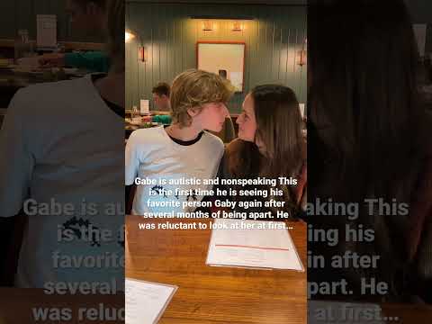
Gabe sees Gaby again for the first time since she moved away months ago. Nonverbal Autism Family
 0:00:46
NEVER buy from the Dark Web.. #shorts
 0:00:11
Logical Reasoning???#viral #vidumzn
 0:08:13
SingleShapefile_Preparation | a GIS Video Tutorial by Gregory Lund
 0:00:15
Cosplay by b.tech final year at IIT Kharagpur
 0:00:29
How much does an ANALYST from a CONSULTANCY make?
 0:00:16
Computer Data Entry // my wife data entry 😁😁
 0:00:25
what it’s like to work at GOOGLE…
Комментарии