filmov
tv
Understanding Autonomous Navigation in ROS2: Mapping, Planning, and Execution

Показать описание
In this video, we dive into the process of autonomous navigation for robots in ROS2 simulation or the real world. Starting with setting up the robot and producing sensor scans, we explore mapping techniques such as online SLAM and g-mapping to create an occupancy grid. We then integrate the navigation stack with the help of YAML files and explain the role of local and global planners and costmaps in executing robot movement.
💾 Github :
🤓 Lets join on Discord :
🖐My Social Profiles :
#ros2 #robotics #gazebo #nav2 #autonomousrobot #SLAM
💾 Github :
🤓 Lets join on Discord :
🖐My Social Profiles :
#ros2 #robotics #gazebo #nav2 #autonomousrobot #SLAM
 0:06:16
Understanding Autonomous Navigation in ROS2: Mapping, Planning, and Execution
 0:22:39
Making robot navigation easy with Nav2 and ROS!
 0:29:26
Nav 2 in ROS 2 for autonomous Navigation using SLAM for Indoor Mobile Robots
 0:38:30
Navigation2 in ROS2 | Autonomous Mobile Robot | Nav2 | Behavior Trees | Odrive| Diff drive Robot
 0:09:47
Autonomous Navigation with Deep Reinforcement Learning Using ROS2
 0:00:56
Autonomous Navigation in ROS2: Mapping, Planning, and Execution
 1:01:27
ROS2 Nav2 - Navigation Stack in 1 Hour [Crash Course]
 0:19:53
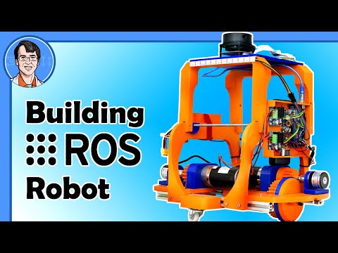
Building a ROS Robot for Mapping and Navigation #1
 0:06:53
Elon Musk says losers use LiDAR. [Explanation video]
 0:08:09
ROS2 Nav2 Integration : Understanding YAML Parameters for Planners, Costmaps, and Velocities
 0:00:42
Autonomous Navigation Using the ROS 2 Navigation Stack (Nav2)
 0:03:42
Building Your Own Autonomous Navigation Robot
 0:09:58
ROS/ROS 2 - What is Robot Operating System (ROS)? - an intuitive understanding
 0:10:51
Exploring Autonomous Navigation with Isaac SIM and NVIDIA Carter | ROS Nav2 Tutorial
 0:00:40
Nav 2 in ROS 2 for autonomous Navigation using SLAM for Indoor Mobile Robots
 0:06:36
What is ROS, When to use it, and Why ? - Robot Operating System Tutorial
 0:11:35
SLAM Robot Mapping - Computerphile
 0:13:31
ROS 2 Navigation - Part 2 (ROS 1 Vs ROS 2 Nav Design in detail)
 0:03:59
UiAbot - SLAM and Autonomous Navigation - ROS2
 0:13:48
ROS 2 Navigation - Part 3 (creating Nav2 Simple demo with TurtleBot3)
 0:07:09
TurtleBot 4 | Mapping & Navigation with ROS 2 Navigation Stack
 0:00:21
ROS Autonomous Navigation stack on RC car
 0:10:46
Autonomous Rover From Scratch (ROS) Part 1
 0:08:22
What Is ROS2? - Framework Overview
Комментарии