filmov
tv
NASA Releases Time-Lapse Of the Disappearing Arctic Polar Ice Cap

Показать описание
Arctic sea ice has not only been shrinking in surface area in recent years, it’s becoming younger and thinner as well. In this animation, where the ice cover almost looks gelatinous as it pulses through the seasons, cryospheric scientist Dr. Walt Meier of NASA Goddard Space Flight Center describes how the sea ice has undergone fundamental changes during the era of satellite measurements.
 0:02:36
NASA Releases Time-Lapse Of the Disappearing Arctic Polar Ice Cap
 0:00:21
NASA Releases Time-Lapse Video Of Changing Colors Of Earth
 0:00:31
NASA Releases Time-Lapse Satellite of Irma
 0:01:00
Aurora Borealis: Nasa releases amazing Northern Lights time-lapse video
 0:01:02
NASA releases incredible time-lapse video of the sun
 0:01:11
NASA Releases Time-Lapse Video Of Depleting Arctic Ice Cap | BOOM
 0:02:56
NASA | 5 Year Time-lapse of the Sun
 0:00:57
NASA made a 20-year time lapse of life on Earth
 0:03:32
Spectacular NASA Time-Lapse Video of the Sun
 0:01:03
NASA releases high-definition video of the sun
 0:00:46
10 years of our sun in one hour, NASA releases time-lapse video
 0:02:43
NASA's five-year timelapse of the sun is stunning | Mashable
 0:02:37
Nasa time-lapse video shows Sun activity over 5 years
 0:02:19
Google Earth Timelapse shows how planet has changed in past 37 years
 0:00:36
Nasa releases stunning aurora time-lapse video captured from space
 0:00:41
Nasa spacecraft captures incredible 12-year time-lapse of entire sky
 0:00:59
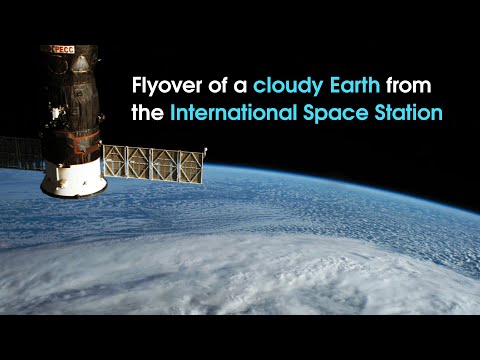
Time-lapse Earth Flyover from NASA Astronaut in Space
 0:06:09
NASA Releases Stunning 10-Year Time-Lapse Of The Sun.
 0:00:14
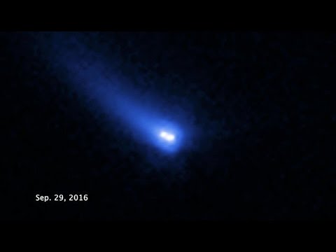
Time-lapse video of 288P
 0:01:20
NASA’s 4K View of April 17 Solar Flare
 0:00:31
NASA releases time lapse photo of solar eclipse
 0:03:11
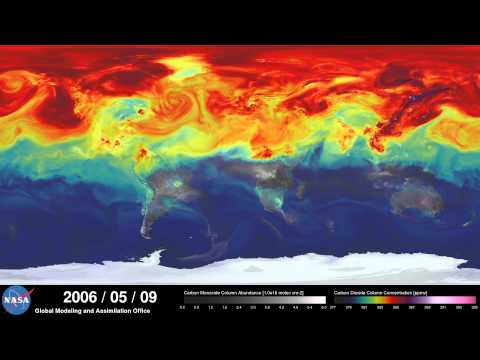
NASA | A Year in the Life of Earth's CO2
 0:00:08
Asteroid Hitting The Moon🌒💥#lunarsurface #telescope #moon #asteroid #nasa #space #shorts
 0:01:02
Watch: 10-year timelapse of the sun
Комментарии