filmov
tv
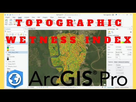
Calculate Topographic Wetness Index (TWI) Using ArcGIS Pro

Показать описание
In this tutorial, uncover the hydrological secrets of landscapes by calculating the Topographic Wetness Index (TWI), a key indicator for soil moisture distribution and water accumulation areas. Using ArcGIS Pro, we’ll guide you through step-by-step processes to transform a Digital Elevation Model (DEM) into meaningful insights for hydrological and environmental applications.
What is TWI?
TWI, also known as the Compound Topographic Index (CTI), models how water flows and accumulates over terrain by integrating two critical topographic features:
• Flow Accumulation: Measures the upslope area contributing water to a point.
• Slope: Determines the terrain's steepness, with steep slopes shedding water and flat areas retaining it.
Through a logarithmic formula, TWI helps normalize these factors, providing a continuous range of values to highlight wet and dry zones.
-----------------------------------------------------------------
Resource link:
🎯 Subscribe for More:
Dive into the world of GIS and remote sensing with expert tutorials on ArcGIS Pro, QGIS, and Google Earth Engine. Like, share, and comment to support our mission of simplifying geospatial analysis for everyone!
-----------------------------------------------------------------
💰🤝🏻Join Membership to get access to perks & Support us🤝🏻💰
-----------------------------------------------------------------
👩💻 Join the Terra Spatial Community:
Engage with fellow learners, share your experiences, and get support on our dedicated community forum.
🌐 Stay connected:
---------------------------------------------------------------
👍 **Don't forget to Like, Share, and Subscribe for more insightful tutorials! 🌐✨
#ArcGISPro #TopographicWetnessIndex #Hydrology #GISAnalysis #RemoteSensing
 0:09:11
 0:16:00
 0:12:43
 0:08:29
 0:14:41
 0:14:33
 0:06:32
 0:12:30
 0:10:48
 0:09:49
 0:15:42
 0:05:27
 0:10:48
 0:06:37
 0:06:28
 0:17:41
 0:14:02
 0:12:16
 0:17:18
 0:12:57
 0:05:57
 0:10:25
 0:14:23
 0:22:39