filmov
tv
GIS Python Tutorial: ArcPy Coding with VS Code and Conda #GIS #Python #Code #ArcPy #ArcGIS Pro
Показать описание
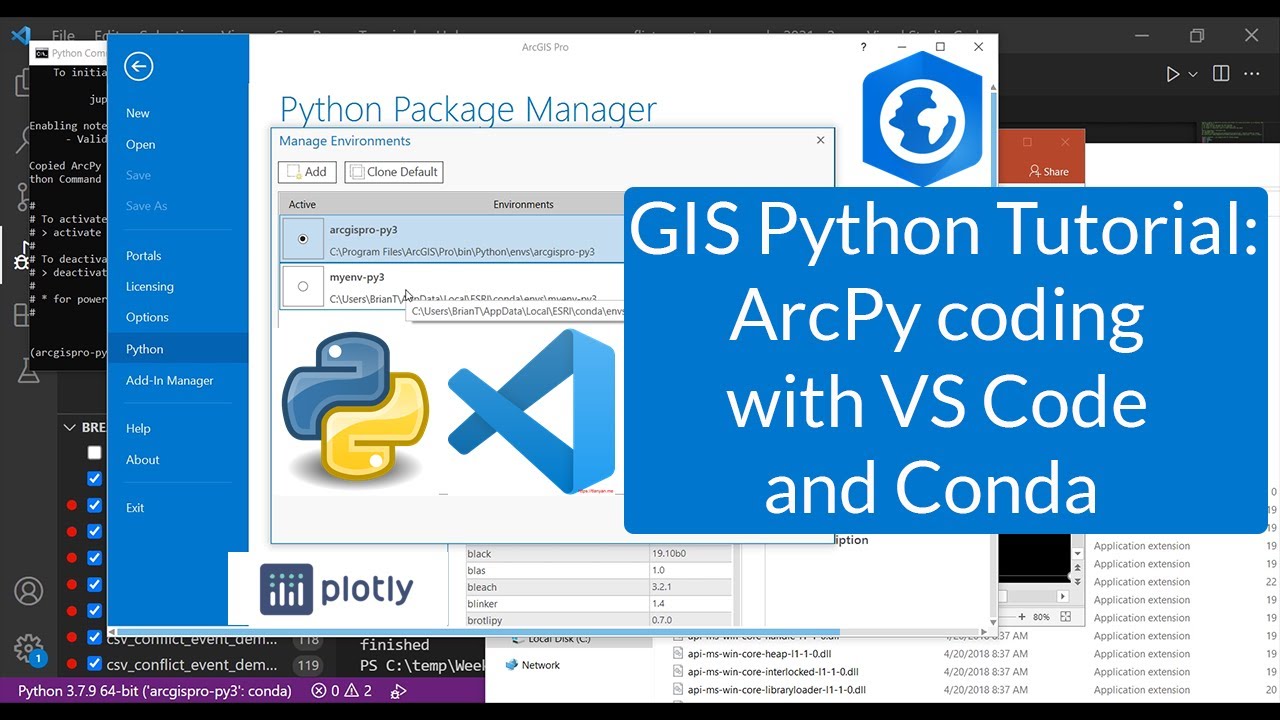
Class is in session! In this video, I will show you how you can use the integrated development environment (IDE) called Visual Studio for writing Python computer code that utilizes the ArcPy library from the ArcGIS Pro GIS default Python environment. I will show you how you can connect the default ArcGIS Pro Python environment to VS Code so you can use the full features of VS Code for ArcPy computer programming. The approach I show is a different than running Python code in the ArcGIS Pro Python window. With the approach demonstrate, you can write, run, and debug ArcPy Python code directly in VS Code without even needing ArcGIS Pro open.
I will also show you a reliable way to clone the default ArcGIS Pro Python environment using Conda and add the Plotly to your clone using Conda.
I use a coding exercise of reading in a comma separated values (CSV) file using Python and then turning content from the CSV into a shape file using ArcPy and a graphic using Plotly. I'll walk you through all the steps in the process and explain all of the code in detail. This video will be particularly useful for people that want to start doing more advanced Python coding using ArcPy with an industry-standard coding environment like Visual Studio Code. This tutorial was recorded during one of my lectures at the Rochester Institute of Technology.
Source Code files and other materials used in the video are available for free to download from this link:
Software and References:
If you liked this and other videos on the geographic information science channel, please like these videos, leave comments, or subscribe to this channel so you can stay informed of new videos.
Subscribe to this channel:
Also, feel free to contact me if you have any questions, I love hearing from the YouTube community.
Thanks for stopping by!
Brian Tomaszewski, Ph.D.
 1:16:17
GIS Python Tutorial: Getting Started with ArcPy and VS Code #GIS #Python #Code #ArcPy
 1:10:31
GIS Python Tutorial: ArcPy Coding with VS Code and Conda #GIS #Python #Code #ArcPy #ArcGIS Pro
 1:03:09
ArcPy Python Coding Lesson: Hurricane Impact Analysis #GIS #Map #Python #disaster
 0:03:35
Three Minutes to Your First Python Script
 0:02:15
Course: ArcPy for ArcMap Level 1: Python Programming for ArcGIS | GIS | Programming Techniques |
 0:12:01
Getting Started with ArcPy (GIS Python Library) for ArcGIS Desktop
 1:10:14
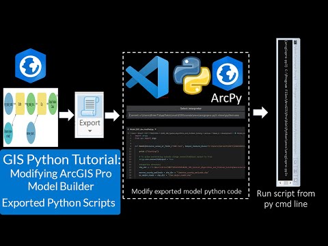
GIS Python Tutorial: Modifying ArcGIS Pro Model Builder Exported Python Scripts #GIS #Python #ArcPy
 1:09:34
GeoSpatial Analysis With Python For Beginners || Use Python For GIS Analysis || The GIS Hub
 0:11:13
Learning Python with GIS: A Lecture for the Absolute Beginner: Part 1 of 5 ( ArcGIS Pro Python Tour)
 0:01:14
GIS Programming Final Project python script using arcpy. #python #arcpy
 0:01:02
Configure PyCharm to use Arcpy tools
 0:10:25
GIS and Python: Top Courses to Learn Geospatial Python
 0:18:13
Just how easy is Python programming in ArcGIS Pro? You only need 7+2 commands for this tool!
 0:58:05
Advanced Custom Raster Processing Using Python
 0:54:09
Python: Map Automation in ArcGIS Pro
 0:02:51
ArcPy for Python Developers using ArcGIS Pro on Udemy - Official
 0:07:36
[PYTHON IN ARC GIS #2]ARCPY | CLIP IN ARC GIS USING PYTHON | GETTING STARTED WITH PYTHON IN ARC GIS
 0:11:49
GIS Python: Clip Analysis Using Arcpy module | For Beginners
 0:04:15
ArcPro Python Environment Setup in VSCode
 0:43:57
Python for Geographers
 0:24:51
ArcPy: Working with Feature Data
 0:06:35
Python Window in ArcMap
 1:00:22
Full Course - Python for Geospatial Data Analysis for Beginners
 0:56:32
GIS Python Tutorial: Gentle Introduction to VS Code and Python Computer Programming #Python #GIS
Комментарии