filmov
tv
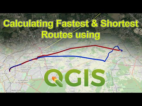
Calculating Shortest and Fastest Paths using QGIS (ORS Tools)

Показать описание
In this tutorial, you will learn how to perform shortest path and fastest path calculations using QGIS with the aid of Open Route Services (ORS Tools) plugin. The paths will be extracted as line features, along with the information such as the distance and the time it would take to travel from the origin to the destination.
 0:10:02
Calculating Shortest and Fastest Paths using QGIS (ORS Tools)
 0:02:46
Network Analysis in ArcGIS- Calculate the shortest route using Network Analyst. #gis #arcgis
 0:03:19
FINDING SHORTEST ROUTE USING NETWORK ANALYST || ARCGIS 10.4
 0:16:36
Shortest & Fastest Routes, Isochrone Maps, Time - Distance Matrix using QGIS
 0:05:19
Network Analysis in ArcGIS- Calculate the shortest route using Network Analyst.
 0:02:43
Finding the Shortest and Quickest Path
 0:04:42
Network problems. Part 1. Shortest path.
 0:15:22
How to Calculate the Shortest and Fastest Routes in QGIS (Open Routing Services-ORS)
 2:48:55
PDSA Quiz-2 Revision Session-1( Week 5 and 6)
 0:07:56
QGIS Basic : Shortest path between points
 0:01:10
QGIS TUTORIAL:Learn Shortest Route Network Analysis In 1 Minute| Zero To Hero
 0:08:24
Dijkstras Shortest Path Algorithm Explained | With Example | Graph Theory
 0:11:51
QGIS Tutorial: Network Analysis (Shortest Path/Route and Service Area)
 0:07:54
Finding the Shortest Path for GIS, CAD, and other Spatial Data
 0:07:54
A Comparison of Pathfinding Algorithms
 0:02:27
Network analyst - find shortest route in ArcGIS - Mapping in GIS
 0:05:01
Shortest path in road network to connect different service areas ARC GIS
 0:00:28
Finding Shortest Paths in Python using OSMnx
 0:02:46
Dijkstra's algorithm in 3 minutes
 0:10:23
Shortest Route
 0:01:38
QGIS Network Routing Shortest Path
 0:06:57
Project Scheduling - PERT/CPM | Finding Critical Path
 0:04:21
Dijkstra's Algorithm (finding shortest path)
 0:08:31
How Dijkstra's Algorithm Works
Комментарии