filmov
tv
Tiny satellites and a new view of humanity | Hard Reset by Freethink

Показать описание
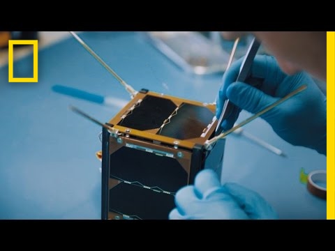
Tiny satellites and a new view of humanity
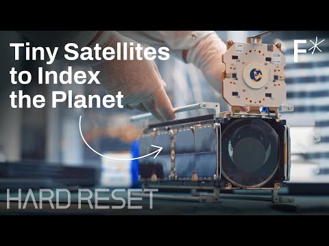
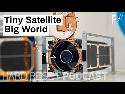
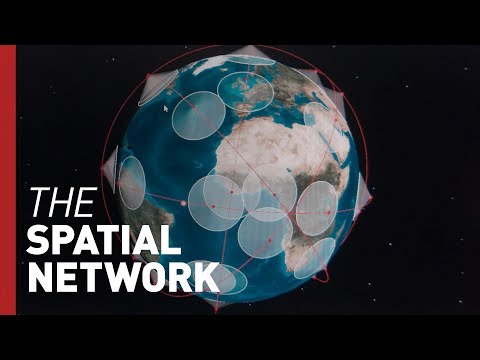
Today, satellite mapping has forever changed the accuracy with which we can map, and AI computer vision systems have made satellite mapping more useful than ever before.
Using AI, satellite mapping revolutionizer, Planet, can automatically identify and categorize what their satellites see, creating something like a true global database of “what’s on the world.”
“Using computer vision, we can abstract out objects. Then we basically build up a database of all of the objects on Earth over time,” Will Marshall, Planet co-founder and CEO, says.
Marshall notes protecting the ecosystem as a key example of what Planet’s technology can do; they can stop illegal logging in advance, because they can see the roads being cut into the forests before the harvest begins. Planet performed the first coral reef satellite mapping project, and can now — because we can watch it change day to day — lookout for coral bleaching or illegal fishing.
◠◠◠◠◠◠◠◠◠◠◠◠◠◠◠◠◠◠◠
Read more of our stories on mapping:
See the first 3D map of the heliosphere
Predator drones are using AI to create faster fire maps
Citizen scientists helped NASA map our cosmic backyard
◠◠◠◠◠◠◠◠◠◠◠◠◠◠◠◠◠◠◠
About Freethink
No politics, no gossip, no cynics. At Freethink, we believe the daily news should inspire people to build a better world. While most media is fueled by toxic politics and negativity, we focus on solutions: the smartest people, the biggest ideas, and the most ground breaking technology shaping our future.
◡◡◡◡◡◡◡◡◡◡◡◡◡◡◡◡◡◡◡
Watch our original series:
Enjoy Freethink on your favorite platforms:
 0:08:53
Tiny satellites and a new view of humanity | Hard Reset by Freethink
 0:00:35
The World's SMALLEST SATELLITES!
 0:00:42
ESAT - a tiny satellite #shorts
 0:25:00
My New Satellite Can Take Your Selfie From Space
 0:00:50
Tiny satellites changing science
 0:08:06
Tiny satellites that photograph the entire planet, every day | Will Marshall
 0:00:35
Deploying a Small Satellite at over 10,000 mph
 0:56:45
Real-time maps made by tiny satellites will change open-source data forever | Hard Reset Podcast #10
 0:07:47
Garmin InReach Users Beware: Satellite Communicators BANNED
 0:07:50
Small Satellites With a Huge Impact | Freethink's The New Space Race
 0:00:15
Starlink satellites train #Shorts
 0:01:36
First pocket rockets take tiny satellites for a spin
 0:00:39
Small satellites, big advances
 0:09:11
Apple IOS 18 Just KILLED Garmin InReach... Here's Why. (Satellite Messaging)
 0:16:08
Starlink’s newest competitor is using next-gen satellites to create internet for all | Hard Reset
 0:07:59
This Small Satellite Could Predict the Next Hurricane | Short Film Showcase
 0:11:14
iPhone Satellite vs Garmin inReach
 0:00:29
NASA Releases a Tiny Satellite to Study Ice Clouds
 0:00:10
SpaceX Starlink Satellite Train 9/25/2022
 0:02:31
ISRO Postpones Docking Mission Of SpaDex Satellites Due To 'Unexpected Satellite Drift' | ...
 0:00:51
This satellite runs on WATER
 0:01:23
The Little Satellite That Could
 0:02:20
HMD OffGrid Device Gives Your Phone Access to Satellite Grids (CES First Look)
 0:02:11
NASA Small Satellites to Demonstrate Swarm Communications and Autonomy
Комментарии