filmov
tv
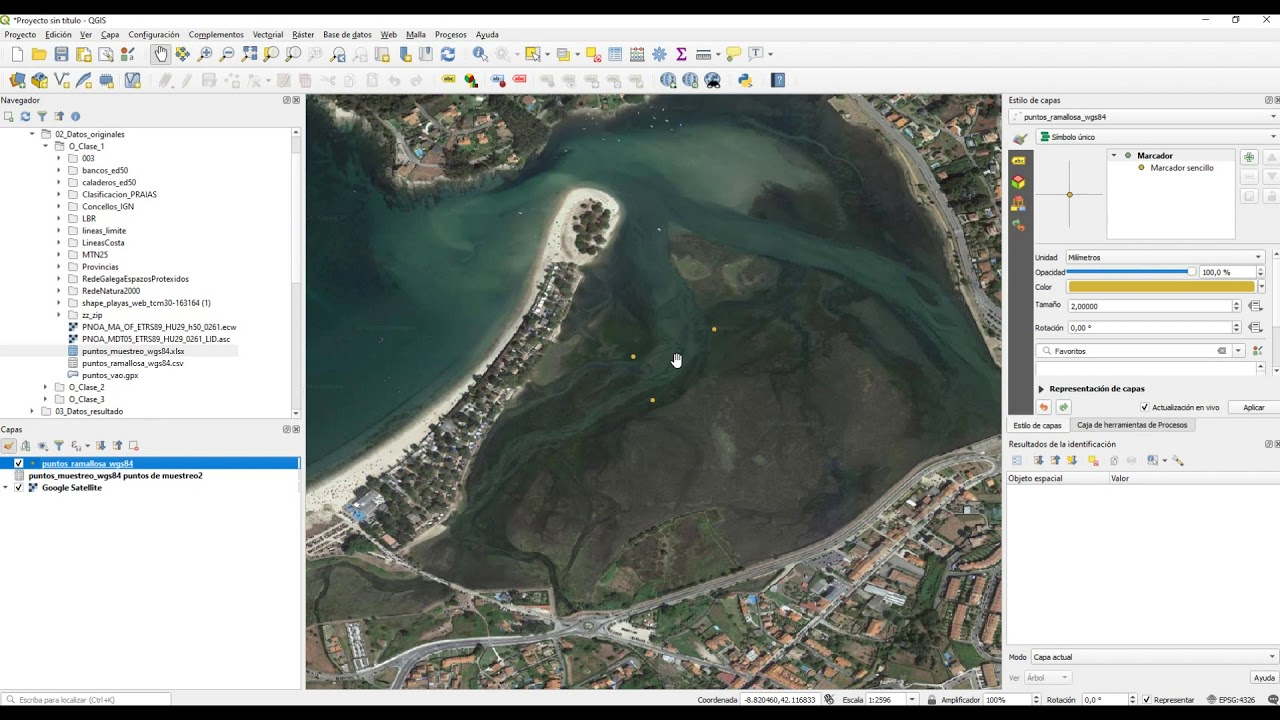
4.How to load xls, csv and gpx files
Показать описание
Tips for converting data from Excel, plain text file data such as csv and outputs files from GPS devices (gpx) into shapefiles in QGIS. All GIS video tips were used as extra didactic resources in the GIS training course for cockles management. This training was held in the framework of COCKLES project "Co-Operation for Restoring CocKle SheLlfisheries and its Ecosystem Services in the Atlantic Area", funded by the Interreg Atlantic Area Programme.
 0:01:40
 0:00:44
 0:03:22
 0:01:39
 0:07:06
 0:01:19
 0:04:14
 0:02:00
 0:05:07
 0:12:59
 0:20:08
 0:05:04
 0:06:12
 0:06:46
 0:04:31
 0:04:02
 0:09:28
 0:02:39
 0:06:47
 0:06:39
 0:04:22
 0:06:22
 0:26:53
 0:00:50