filmov
tv
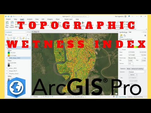
Calculating Topographic Wetness Index in ArcGIS | SRTM DEM | 2023

Показать описание
Hello Dear Viewers, Easily Learn how to calculate Topographic Wetness Index (TWI) in ArcGIS. For Calculating TWI DEM or DTM data is required. Topographic Wetness Index is also referred as Compound Topographic Index (CTI). Data Used in the Tutorial: Processed using SRTM data, SRTM is available from EarthExplorer, USGS Website. USGS EROS Archive - Digital Elevation - Shuttle Radar Topography Mission (SRTM) 1 Arc-Second Global.
---------------------------------------------------------------------
--------------------------------------------------------------------
Join this channel to get access to perks:
--------------------------------------------------------------------
Steps Coved in the Video:
00:00 Introduction
01:05 Step 1: Add DEM to ArcGIS
01:15 Step 2: Project Raster
04:08 Step 3: Fill DEM
06:04 Step 4: Flow Direction
06:57 Step 5: Flow Accumulation
08:45 Step 6: Slope in Degree
09:35 Step 7: Radians of Slope
12:22 Step 8: Tan Slope
15:40 Step 9: Flow Accumulation Scaled
17:09 Step 10: TWI
18:10 Result
18:17 Symbology - Class
19:50 Clip Raster - Study Area
21:24 Finally TWI for Study Area - Done
--------------------------------------------------------------------
More Information about Topographic Wetness Index:
What is Topographic Wetness Index?
The topographic wetness index (TWI) was developed by Beven and Kirkby (1979) within the runoff model TOPMOD.
It is defined as ln(a/tanβ) where a is the local upslope area draining through a certain point per unit contour length and tanβ is the local slope.
--------------------------------------------------------------------
Important Links:
1. To know more about Degrees to Radians Conversion visit:
2. Earth Explorer for Data Access:
SRTM 1 Arc-Second Global – 30m (Used for this Study),
--------------------------------------------------------------------
#TopographicWetnessIndex #arcgis #SRTMDEM #earthexplorer
 0:09:11
Topographic Wetness Index (TWI) in ArcGIS
 0:14:33
Calculating Topographic Wetness Index in ArcGIS | 2023
 0:06:32
Calculate the Topographic Wetness Index in QGIS
 0:08:29
How to calculate Topographic wetness index using ArcGIS
 0:14:41
How to calculate Topographic wetness index using ArcGIS
 0:10:48
Topographic Wetness Index (TWI) From DEM in ArcGIS
 0:03:03
GIS: Calculate Topographic wetness index in SAGA
 0:12:30
Topographic wetness Index (TWI) mapping
 0:06:28
Calculate TWI in QGIS
 0:12:43
Calculate Topographic Wetness Index (TWI) using ArcGIS
 0:05:27
QGIS Tutorial: Method 1 for Calculating Topographic Wetness Index (TWI)
 0:15:42
QGIS Tutorial : Method 2 & 3 || Calculating Topographic Wetness Index TWI
 0:05:57
Topographic wetness index calculations in Arcgis
 0:10:48
How to calculate Topographic wetness index(TWI)/ compound topographic index (CTI) using ArcGIS
 0:03:22
GIS: Calculating Topographic Wetness Index (choosing from different algorithms)
 0:17:18
Calculate Topographic Wetness Index and Create a Processing Tool in QGIS
 0:08:45
Topographical Indies: SPI, TWI or CTI and STI
 0:06:37
Generate Topographic Wetness Index (TWI) from Digital Elevation Model (DEM) in ArcGIS
 0:22:25
Calculating Topographic Wetness Index in ArcGIS | SRTM DEM | 2023
 0:10:25
How to Calculate Topographic Wetness Index using ArcGIS | Flood Mapping
 0:09:49
How to Calculate Topographic Wetness Index using ArcGIS Pro | Flood Mapping
 0:14:23
Topographic Wetness Index (TWI) or Compound Topographic Index (CTI) in ArGIS
 0:00:16
Sensitivity assessment of the TWI formula of TOPMODEL (hydrology)
 0:14:02
Hydrology in ArcGIS Pro, Lab Exercise 10: The Topographic Wetness Index (TWI)
Комментарии