filmov
tv
Land Use Land Cover or Urban Growth Prediction Using IDRISI SELVA and TERRASAT | Tech Geographer |

Показать описание
Land Use Land Cover or Urban Growth Prediction Using IDRISI SELVA and TERRASAT || Tech Geographer || #urbangrowthpredication #CAMarkov #LULCpredication #techgeographer #predication #remotesensing
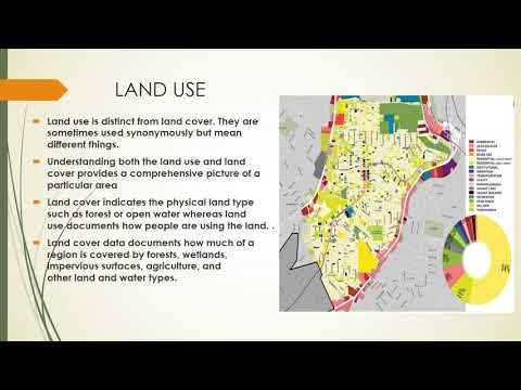
Note - IDRISI SELVA & TERRASAT has similar steps for the LULC prediction.
paper for citation
Note - IDRISI SELVA & TERRASAT has similar steps for the LULC prediction.
paper for citation
 0:17:10
how to download land use, land cover data from usgs and create lulc Map? How to download lulc data
 0:22:04
How To Make a Landuse and Landcover Map in ArcGIS
 0:10:01
Land use/Land cover Change detection Analysis for an Area over a certain timeline like 1989 to 2020
 0:08:43
12 STANDARD: GEOGRAPHY HUMAN SETTLEMENTS : DIFFERENCE BETWEEN LAND USE & LAND COVER
 0:10:50
Supervised Image Classification | Land Use & Land Cover Map in ArcGIS
 0:25:21
How to Create LULC using ArcGIS/ Supervised Classification and Calculate Area of LULC
 0:13:15
How to create a Land use land cover map using ArcGIS derived from ESA Sentinel 2 imagery?
 0:30:43
Land Use Land Cover Mapping | Image Classification Using landsat 8|Supervised classification| ArcGis
 0:57:19
Google Earth Engine: An Introduction for Complete Beginners for GIS and Remote Sensing analysis
 0:29:53
LULC change detection using ArcGIS | 2001 & 2021
 0:10:12
ESRI Land Use Land Cover Data 2022 Download || 10M Resolution Latest Land Cover Data || The GIS Hub
 0:30:19
Lecture 62: Land use, land cover monitoring and change detection – Part 1
 0:14:39
Prediction of Land Use/Land Cover Change using QGIS and ArcGIS (2010-2020-2030)
 0:18:18
Free download Latest Landuse and Landcover (LULC) raster data for whole world from Esri landcover
 0:32:01
Landsat 8 Image Classification using QGIS
 0:17:21
How To Download Land Use and Land Cover Information (LULC) Map For Any Region
 0:00:32
Land use, land use change and forestry (LULUCF)
 0:10:06
Accuracy Assessment of a Land Use and Land Cover Map
 1:13:10
🛑How to make LANDUSE AND LAND COVER CHANGE mapping using Google Earth Engine | LULC change detection...
 0:08:24
Download Free Landuse and Landcover from Bhuvan | QGIS | Thematic Services
 0:19:56
Creating Land Cover Maps in QGIS # QGIS Tutorial
 0:06:03
Land Cover Change Google Earth Pro |Land Use Land Cover Change Google Earth
 0:05:02
Land use land cover (LULC) Supervised Classification | ArcGIS Pro
 0:02:51
How To: Use Esri’s Land Cover Classification Model for Landsat 8 Imagery
Комментарии