filmov
tv
Python GIS - Create a Raster (GDAL)

Показать описание
Use Python to create a new raster with the GDAL module. This Python GIS tutorial will teach you how to easily make a new raster layer. First we'll cover how to make a generic raster layer, then we use information from an existing raster to give our new raster the same geotransformation, size, and projection information. Use Python GIS to automate and customize GIS workflows and tasks.
 0:03:35
Three Minutes to Your First Python Script
 0:13:37
Python GIS - Create a Raster (GDAL)
 0:15:12
FASTEST Way to Learn Modern GIS and ACTUALLY Get a Job
 0:05:21
Python GIS Examples - Killer One-Line Expression to Get You Some Python Chops
 0:05:31
Python is Your Friend In GIS! Create a List of Feature Class Field Names | Python & ArcGIS Pro
 0:04:05
Python is Your Friend In GIS! Know How to Get Field Data Into a Python List | Python & ArcGIS Pr...
 0:05:58
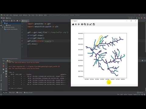
Python GIS - Open and Display a Shapefile with Geopandas
 1:16:17
GIS Python Tutorial: Getting Started with ArcPy and VS Code #GIS #Python #Code #ArcPy
 0:02:55
Gis: ArcGIS API for Python - determine if feature service was published from ArcGIS Pro?
 0:24:46
How I Would Learn GIS (If I Had To Start Over)
 0:11:13
Learning Python with GIS: A Lecture for the Absolute Beginner: Part 1 of 5 ( ArcGIS Pro Python Tour)
 0:01:00
5 tips on how to get a #GIS #Job #mapping #employment #geospatial #python #data
 0:28:10
Stef's GIS Lab - Using Python in ArcGIS Pro 1
 0:48:42
An Absolute Beginner's Guide to Python GeoPandas
 0:00:50
#ChatGPT for #GIS #Python Developers
 0:40:39
Anders Lehmann - How to GIS with Python
 0:56:32
GIS Python Tutorial: Gentle Introduction to VS Code and Python Computer Programming #Python #GIS
 1:12:46
Learn GIS - QGIS Full Course for Beginners (New for 2024)
 0:12:01
Getting Started with ArcPy (GIS Python Library) for ArcGIS Desktop
 1:20:16
Introduction to Python GIS for Data Science
 0:36:05
AutoGIS Lesson 1.1 - Intro to Python GIS; Installing Python packages
 0:22:54
Python GIS - Subset Raster with GDAL
 0:26:09
How to use GeoDjango (import GIS shapefile with Python)
 0:09:52
Python GIS - Copy a Raster (GDAL)
Комментарии