filmov
tv
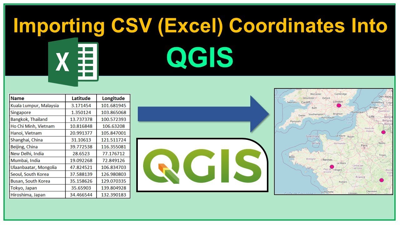
Importing CSV (Excel) Coordinates into QGIS
Показать описание
In this tutorial, we will show you how to import comma separated value (CSV) data which contains latitude & longitude into QGIS, how to plot the points on a map, and how to export the data into an ESRI Shapefile.
 0:06:01
Importing CSV (Excel) Coordinates into QGIS
 0:08:21
Import Latitude & Longitude Coordinates to Google Earth from CSV Excel file
 0:04:30
Importing Excel Coordinates to ArcMap and Plotting
 0:04:55
How To Import CSV (Excel) coordinate into QGIS
 0:07:26
Importing Excel (CSV) Coordinates into QGIS
 0:12:57
Importing CSV Coordinates (Excel) into QGIS
 0:08:56
Importing Excel file (CSV) Coordinates in QGIS (ENGLISH)
 0:05:52
Import Latitude & Longitude Coordinates to ArcGIS Earth from CSV Excel file
 0:02:18
Importing CSV files in QGIS Project
 0:03:58
Import points by Coordinates Latitude Longitude in Google Earth by csv or text file
 0:06:26
How to Add Excel file CSV with Shape file in QGIS 2021 ENGLISH
 0:11:50
Add XY Coordinate Data to ArcGIS Pro from Excel
 0:08:35
Importing Coordinates CSV file into QGIS and Labelling the Points
 0:03:00
Excel data to Google earth. How to convert excel files into kml or kmz
 0:01:38
How to Convert CSV file into Shapefile in ArcGIS
 0:03:11
Import coordinates to QGIS from EXCEL file (CSV)
 0:02:53
Importing CSV Text Files with XY Data into ArcGIS Pro
 0:06:10
importing csv excel file with xy data to arcgis pro
 0:04:22
Import Points using .csv file | AutoCad CIVIL 3D 2022
 0:08:04
Importing Excel (CSV) Coordinates into QGIS | Import excel to QGIS
 0:17:00
Import Latitude & Longitude Coordinates to Google Earth Engine from CSV Excel file || Earth Engi...
 0:04:01
Importing and Mapping a CSV File into Google Earth
 0:03:02
How to add a CSV file with Coordinates into ArcGIS Online
 0:08:46
Convert Excel Data into a Google Map
Комментарии