filmov
tv
Monitoring of reservoir surfaces, altitude and volumes using Sentinel-2 and Jason-3 satellite data.

Показать описание
Thomas Ledauphin, from SERTIT France, present a method using Sentinel-2 and Jason-3 satellite data to monitor reservoir surfaces, altitude and volumes applied here to Lacs de Seine Reservoir in France.
This presentation has been prepared for Theia workshop on the uses of remote sensing for water quality and interfaces organised on 12 October 2021 in Montpellier, France.
This presentation has been prepared for Theia workshop on the uses of remote sensing for water quality and interfaces organised on 12 October 2021 in Montpellier, France.
 0:10:13
Monitoring of reservoir surfaces, altitude and volumes using Sentinel-2 and Jason-3 satellite data.
 0:05:01
227 Monitoring of reservoir surfaces altitudes and volumes using Sentinel 2 and Jason 3 satellite
 0:14:27
Excel: Reservoir Storage Monitoring from Elevation & Area - Kajaki Reservoir
 0:01:54
Elevated Reservoir Level Control - Altitude Pilot & Modulating Altitude Valve
 0:04:57
2023 | Measuring Water Level Changes in Reservoir using Jason-3 Altimetry Mission - Aman Bagrecha
 1:33:27
NASA ARSET: Mapping and Monitoring Lakes and Reservoirs with Satellite Observations, Part 1/3
 0:13:49
How to estimate Reservoir Evaporation Losses using free data - Kajaki reservoir, Afghanistan
 0:03:30
Altimetry explained
 0:32:34
HEC HMS Exercise 8 - Reservoir Using Outflow Curve
 0:00:49
Sewer System Animation for Public Works - MMSD
 0:01:16
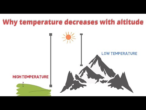
Why temperature decreases with altitude?#why_temperature_decreases_with_height #temperature#height
 0:26:55
QGIS: Reservoir volume from DEM - Kajaki Reservoir, Afghanistan
 1:30:33
NASA ARSET: Mapping and Monitoring Lakes and Reservoirs with Satellite Observations, Part 3/3
 0:11:00
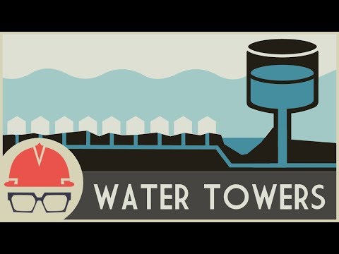
How Water Towers Work
 0:10:03
Surface Water Data of any location of the World for free
 0:49:46
Monitoring the Storage Volume of Water Reservoir Using Google Earth Engine:Water Resource Management
 0:12:07
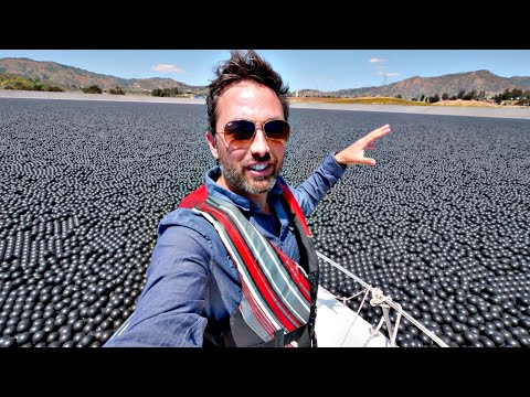
Why Are 96,000,000 Black Balls on This Reservoir?
 0:07:06
Basics of Reservoir Operations
 0:01:45
Pressure Demo: Water Column
 0:01:48
Capillarity and Surface Tension | Surface Tension | Physics
 0:01:12
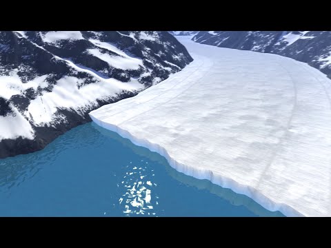
Animation: How a Glacier Melts
 0:07:39
Excel: How to add a 2nd Axis to a Chart - Reservoir Elevation-Area-Storage Capacity Curves
 0:04:25
ID 487 Insar Techniques to Monitor Gas Reservoir Pressure.
 0:56:32
NASA ARSET: Satellites, Sensors, and Earth Systems Models for Water Resources Management
Комментарии