filmov
tv
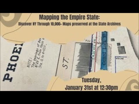
Mapping the Empire State: Discover New York through 10,000+ Maps Preserved at the State Archives
Показать описание
When one hears the term “primary source,” maps may not be the first thing that comes to mind—but these records are often rich resources, full of information. Join us for a visually compelling and engaging program that highlights some of the cartographic resources preserved and made accessible at the State Archives. The rich collection of maps preserved by the State Archives spans the colonial period to the present day. These maps, and the information they contain, serve as a valuable resource for understanding communities, major public works projects like the Erie and Oswego canals, the changing environment and the lives of the individuals who have lived in our state over the past 400 years.
 0:17:38
 0:01:00
 0:01:00
 0:00:16
 0:00:27
 0:00:11
 0:00:41
 0:01:00
 0:05:16
 0:22:47
 0:00:31
 0:00:59
 0:01:01
 0:01:00
 0:00:20
 0:01:00
 0:00:47
 0:00:51
 0:00:18
 0:04:12
 0:00:36
 0:00:11
 0:01:00