filmov
tv
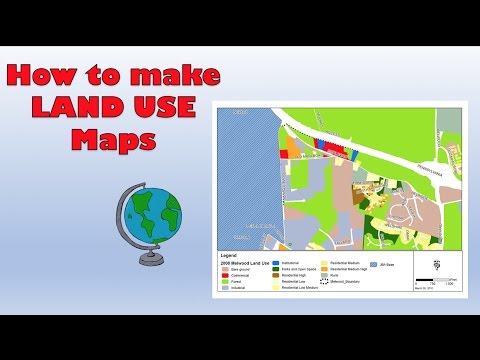
Mapping Land Use and Land Cover from MODIS: A Step-by-Step Tutorial

Показать описание
#LandUseAndLandCover#MODISdata#RemoteSensingTutorial#ImageClassification#lulc
In this step-by-step tutorial, we will guide you through the process of mapping land use and land cover from MODIS (Moderate Resolution Imaging Spectroradiometer) data. MODIS provides valuable satellite imagery that can be utilized for various applications, including land cover analysis.
By following along with this tutorial, you will gain the skills and knowledge needed to create your own land use and land cover maps using MODIS data. Accurate land use and land cover information is essential for various environmental and urban planning applications.
Don't miss out on this valuable tutorial! Be sure to subscribe to our channel for more exciting tutorials on geospatial analysis, remote sensing, and mapping techniques. Hit the notification bell to stay updated with our latest videos. Get ready to unlock the power of MODIS and elevate your mapping skills!
Don't forget to like, share, and subscribe to our channel for more informative content.
Land Use and Land Cover mapping have various applications across different fields. Here are some common applications:
@ Environmental monitoring: LULC mapping assesses changes in land cover over time, aiding environmental monitoring and conservation efforts.
@ Urban Planning: LULC maps inform urban planners about existing land use patterns for sustainable development and infrastructure design.
@ Natural Resource Management: LULC mapping helps manage and conserve natural resources by identifying areas at risk and supporting sustainable utilization.
@ Disaster Management: LULC mapping identifies areas prone to hazards, assesses vulnerability, and aids in disaster response planning.
@ Agriculture and Food Security: LULC mapping assists in agricultural planning, crop monitoring, and estimating yields for improved food security.
@ Biodiversity Conservation: LULC mapping identifies critical habitats and ecosystems, supporting biodiversity conservation efforts
@Climate Change Analysis: LULC mapping provides baseline data to assess land cover change impacts on climate systems, carbon storage, and the water cycle.
@Infrastructure Development: LULC mapping identifies suitable areas for infrastructure projects while minimizing environmental impact.
Related Tags: #MODISMappingTutorial #LandUseMapping #LandCoverMapping #SatelliteImagery #RemoteSensingAnalysis #GeospatialData #MODISDataProcessing #ImageClassification #GISMapping #MODISPreprocessing #DataVisualization #EnvironmentalMapping #UrbanPlanning #GeospatialTechnology #MODISAnalysis #LandUseClassification #LandCoverClassification #MODISSatellite #MODISDataAnalysis #EarthObservation.
======Contents of this video======
RS GIS HOME Facebook Page:
RS GIS HOME Facebook Groups:
Join our Free Telegram Channel
Playlists:
Satellite Data Download:-
Remote Sensing and GIS tutorial:-
ArcGIS for beginners:-
ArcGIS Model Builder:-
Excel to ArcMap:-
Google Earth Pro:-
DGPS :-
Geomatics Engineering Gate 2022 || Free Course:-
___________________________________________________________________________________
About the Channel:-
On this YouTube Channel:
Knowledge of Remote Sensing and GIS and how it works in the world
Videos and Lectures on Remote Sensing and GIS Techniques and their applications
A brief explanation of the Practical Portion of GIS & Remote Sensing
Boost your concept with Remote Sensing and GIS
Keep yourself updated with the new techniques of Remote Sensing and GIS field
One-stop platform for Remote Sensing and GIS
So stay connected with us by just clicking on the Red Subscribe button and pressing the bell icon.
___________________________________________________________________________________
References:
Thank You.
 0:27:21
Mapping Land Use and Land Cover from MODIS: A Step-by-Step Tutorial
 0:13:15
How to create a Land use land cover map using ArcGIS derived from ESA Sentinel 2 imagery?
 0:17:10
how to download land use, land cover data from usgs and create lulc Map? How to download lulc data
 0:22:04
How To Make a Landuse and Landcover Map in ArcGIS
 0:29:53
LULC change detection using ArcGIS | 2001 & 2021
 0:10:12
ESRI Land Use Land Cover Data 2022 Download || 10M Resolution Latest Land Cover Data || The GIS Hub
 1:13:10
🛑How to make LANDUSE AND LAND COVER CHANGE mapping using Google Earth Engine | LULC change detection...
 0:27:04
Landuse & Landcover Mapping using ArcGIS | Supervised Classification
 0:06:40
Bihar Land Map Order l How to online order bihar land map l Bihar bhumi naksha online
 0:19:56
Creating Land Cover Maps in QGIS # QGIS Tutorial
 0:10:50
Supervised Image Classification | Land Use & Land Cover Map in ArcGIS
 0:18:18
Free download Latest Landuse and Landcover (LULC) raster data for whole world from Esri landcover
 0:08:24
Download Free Landuse and Landcover from Bhuvan | QGIS | Thematic Services
 0:22:28
How to make a land use map using Google earth in QGIS
 0:10:51
Download Free ESRI 10m Land Use/Land Cover Maps with LULC ESRI: A Comprehensive Tutorial
 0:10:06
Accuracy Assessment of a Land Use and Land Cover Map
 0:19:15
land use land cover change analysis | lulc change detection in ArcMap
 0:06:59
How to create a Land Use Survey on Google Maps - Course work tips (GCSE, A Level and IB)
 0:25:21
How to Create LULC using ArcGIS/ Supervised Classification and Calculate Area of LULC
 0:10:01
Land use/Land cover Change detection Analysis for an Area over a certain timeline like 1989 to 2020
 0:17:21
How To Download Land Use and Land Cover Information (LULC) Map For Any Region
 0:14:05
Maps, Map Types, Scale and Where to buy 10 Minutes to better Land Navigation Part 8
 0:17:37
What is land use and land cover (LULC) map| understanding Level-1, Level-2, and Level-3 classes?
 0:05:02
Land use land cover (LULC) Supervised Classification | ArcGIS Pro
Комментарии