filmov
tv
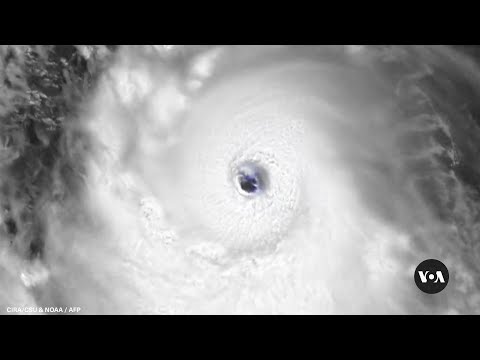
NOAA satellite images show Hurricane Dorian moving towards US coast | AFP

Показать описание
The National Oceanic and Atmospheric Administration (NOAA) releases a 5-hour loop captured by its satellite on Wednesday, September 4, showing Hurricane Dorian moving along the US coast after killing at least 7, in the Bahamas. IMAGES SATELLITE IMAGES
Abonnez-vous à la chaîne de l'AFP, et pensez à activer les notifications 🔔
Abonnez-vous à la chaîne de l'AFP, et pensez à activer les notifications 🔔
 10:59:31
 6:21:05
 0:00:31
 0:03:31
 0:07:18
 8:03:38
 0:02:11
 0:05:26
 0:00:23
 0:00:25
 3:58:27
 0:00:46
 5:17:19
 0:00:06
 0:01:19
 0:00:32
 0:00:04
 0:00:24
 0:00:33
 10:52:26
 0:00:22
 0:00:46
 0:09:14
 0:01:57