filmov
tv
NASA Earthdata Webinar: NASA Soil Moisture Active Passive Mission (SMAP) Data Products

Показать описание
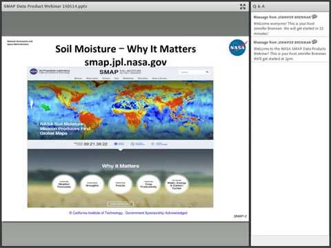
NASA's Soil Moisture Active Passive (SMAP) Mission will produce global soil moisture data at unprecedented levels of accuracy and resolution. The SMAP Spacecraft launched on January 31, 2015. The SMAP instruments are deployed and operating. Data will be flowing and publicly available before the end of this calendar year.
These data will both enable and enhance research into many major endeavors, including: * The processes that link the water, energy and carbon cycles, * Weather and climate prediction models, * Global quantification of the net flux of carbon in Boreal landscapes, and * Flood prediction and drought monitoring capabilities Indeed, the SMAP mission team anticipates that scientists, social scientists and policy makers will develop even more applications using SMAP data. This webinar provides existing and potential new users with an overview of the content and the format of all fifteen SMAP data products.
For NASA NSIDC DAAC SMAP Data Information:
 1:19:37
NASA Earthdata Webinar: NASA Soil Moisture Active Passive Mission (SMAP) Data Products
 1:09:06
Earthdata Webinar: Discover Earth Science Data with NASA Earthdata Search
 0:50:56
NASA Earthdata Webinar: Discover New Data Products at the NASA LP DAAC
 1:08:16
NASA Earthdata Webinar: Discover NASA Near Real-Time Earth Science Data using LANCE
 1:03:29
NASA Earthdata Webinar Series: Real-Life Uses of Radar Data for Real-Life Scientists
 1:07:01
Earthdata Webinar Series: Simplified NASA Earth Science Data Access through OPeNDAP
 1:12:45
NASA Earthdata Webinar Series: A Beginner's Tour: NASA EOSDIS Data Discovery and Access
 2:09:01
NASA ARSET: Soil Moisture for Agricultural Applications, Part 2/4
 1:12:58
Increasing NASA Earth Science Data Accessibility with GIS
 1:09:32
NASA Earthdata Webinar Series: Explore NASA Socioeconomic Data using Web Mapping Services
 0:10:17
NASA Data Made Easy: Part 3- ORNL DAAC's Tools for Ecological Research
 0:49:54
NASA Earthdata Webinar Series: How To Access NASA ASTER and MODIS Data with Earth Explorer Tool
 0:15:43
NASA's Soil Moisture Active Passive Mission
 0:28:29
NASA's Remote Sensing Toolkit Webinar
 1:01:10
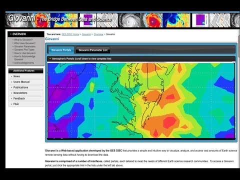
NASA Earthdata Webinar Series: Giovanni - Access and Visualize Earth Science Data Online
 0:09:29
NASA Data Made Easy: Part 1- Introduction to NASA Data
 1:06:31
NASA Earthdata Webinar Series: GHRSST Data Discovery and Access Tools
 1:12:02
Earthdata Webinar Series: Discover Simplified SAR Solutions at NASA ASF DAAC
 0:14:28
Using NASA Earth Observations to Enable Open Science with GIS
 0:59:14
Exploring Earth’s Land Surface with Suomi NPP NASA VIIRS Land Data
 1:11:49
Earthdata Webinar: View from NASA Terra's Zoom Lens: All about the ASTER Sensor
 1:43:26
NASA ARSET: Groundwater Monitoring using Observations from NASA’s GRACE Missions
 1:00:57
NASA Earthdata Webinar Series: MODIS Global Subsetting and Visualization Tool
 1:10:45
NASA Earthdata Webinar: Implementing ISO 19115 Standards: NASA Earth Science Data
Комментарии