filmov
tv
Changing the Map of Europe Back to 1914

Показать описание
What did Europe look like on the verge of World War I? This video redraws the map of Europe from 2014 to 1914 while explaining the differences.
ERRATA
• Vatican City was established in 1929 and should not appear on the final 1914 map.
• The central parts of the 1914 German border with Russia are slightly too advanced.
• Germany in 1914 should also include a very small part of present-day eastern Czechia (the so-called 'Hultschiner Ländchen').
• Spanish Morocco is shown as slighly too large.
• The Dutch province of Flevoland didn't yet exist in 1914, as it was still under water.
• The Franco-Italian border is very slightly off, as Italy in 1914 should include some minor areas of France.
———
RELATED VIDEOS
Changing the Map of Europe Back to 1815
Changing the Map of Europe Back to 1933
———
FOLLOW / SUPPORT
———
 0:13:03
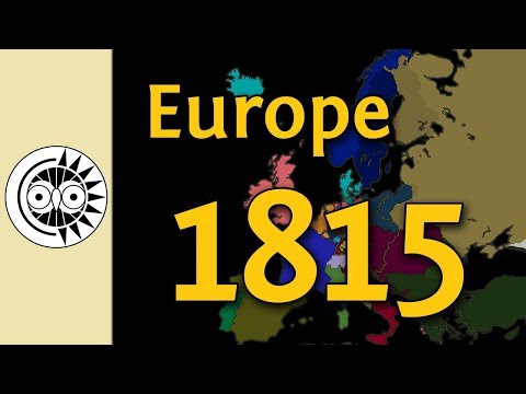
Changing the Map of Europe Back to 1815
 0:01:35
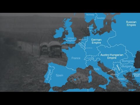
Animated Map Shows How World War I Changed Europe's Borders
 0:11:45
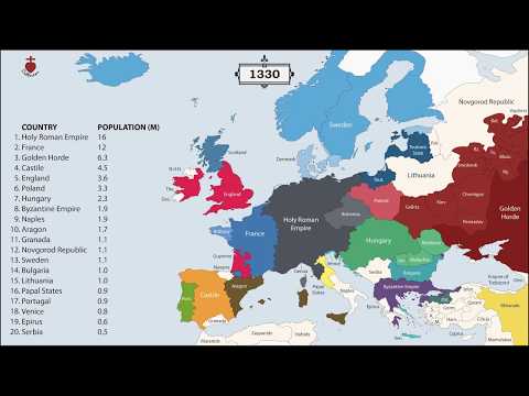
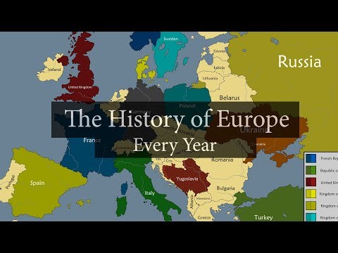
The History of Europe: Every Year
 0:07:08
Changing the Map of Europe Back to 1914
 0:06:16
Changing the Map of Europe Back to 1933
 0:13:09
I Tried Fixing EUROPE'S Borders as an American...
 0:11:50
The History of Europe [2600 BC - 2020 AD] Every year
 0:08:02
Fixing Europe's Borders (Fixing The World Map)
 0:00:12
Most liked comment changes Europe Part 3 #geography #mapping #map
 0:05:49
All Territories Ever Occupied by Each European Country
 0:06:20
Europe’s climate in 2050
 0:11:00
1000 Years Time Lapse Map of Europe
 0:05:02
Redrawing The Map Of Europe - Alternate History
 0:00:09
comment with most likes gets to change the map #europe #map #history #mapper #mapping
 0:01:47
1918 - 1923. How WWI CHANGED the map of EUROPE, in 1 minute.
 0:00:07
Your Comments Change the Map of Europe! #countrys #europe #geography #shorts #mapping #map #mapper
 0:00:09
day 17 whan i change europe #map #europe #geography #mapping #edit #mapper
 0:00:07
Comments Change Europe Map Season 3! Part 19!… #shorts
 0:00:08
Map of Europe, but comments change it (p.8)
 0:00:08
#comment #change #europe #history #geography #map #countrys #countries #maps
 0:00:06
change The map #viral #meme #country #map #europe #geography
 0:17:28
Europe: Timeline of National Flags: 1000 - 2019
 0:00:05
Top 2 Comments Will Change The Map! #europe #geography #viral #shorts #change
 0:00:11
day 12 when i change europe #europe #map #mapper #mapping
Комментарии