filmov
tv
Calculating Geometry in ArcGIS Pro

Показать описание
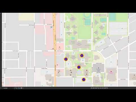
A prior video from @DEEGSNCCU discusses how to calculate new columns from existing columns. However, what if we want to calculate the area, centroids (X and Y) or perimeter of our features? The Calculate Geometry utility is able to do this using projection information to calculate area in different units such as square miles, acres or square feet. More robust calculations allow you to calculating the minimum X, minimum Y, number of parts and even the number of holes (for polygons).
These videos have been created in support of teaching and research in the field of GIS (Geographic Information Systems) for the Department of Environmental, Earth and Geospatial Sciences at North Carolina Central University (NCCU). Established in 1910, NCCU is located in Durham, North Carolina, and serves about 8,500 students. The mission of our department is to promote intellectual, professional, and personal excellence through the highest quality instruction, research, and service in the environmental, earth and geospatial sciences. Its vision is to be recognized as a regional, statewide, and national resource for students and society as well as professionals who work in the many fields that are encompassed by the environmental, earth, and geospatial sciences. Students in our programs currently focus their studies in the fields of seismology, natural hazards, GIS (Geographic Information Systems) and Remote Sensing applications, environmental health & impacts and remediation technology among others. Our courses are designed to provide students with the analytical and methodological skills necessary to understand or derive explanations for individual occurrences, for recurring processes, and for invariable as well as statistical regularities in the earth’s lithosphere, hydrosphere, atmosphere, and biosphere. The department prides itself in former students who fostered these skills and have gone onto successful careers in the field at places such as the North Carolina Department of Transportation, City of Durham, Environmental Protection Agency, Lowe’s Corporation, Environmental Protection Agency, National Forest Service, Army Corps of Engineers, real estate firms and private contractors or students who have gone onto Ph.D. programs at places such as North Carolina State University, North Carolina A&T State University and the University of North Carolina, Greensboro.
These videos have been created in support of teaching and research in the field of GIS (Geographic Information Systems) for the Department of Environmental, Earth and Geospatial Sciences at North Carolina Central University (NCCU). Established in 1910, NCCU is located in Durham, North Carolina, and serves about 8,500 students. The mission of our department is to promote intellectual, professional, and personal excellence through the highest quality instruction, research, and service in the environmental, earth and geospatial sciences. Its vision is to be recognized as a regional, statewide, and national resource for students and society as well as professionals who work in the many fields that are encompassed by the environmental, earth, and geospatial sciences. Students in our programs currently focus their studies in the fields of seismology, natural hazards, GIS (Geographic Information Systems) and Remote Sensing applications, environmental health & impacts and remediation technology among others. Our courses are designed to provide students with the analytical and methodological skills necessary to understand or derive explanations for individual occurrences, for recurring processes, and for invariable as well as statistical regularities in the earth’s lithosphere, hydrosphere, atmosphere, and biosphere. The department prides itself in former students who fostered these skills and have gone onto successful careers in the field at places such as the North Carolina Department of Transportation, City of Durham, Environmental Protection Agency, Lowe’s Corporation, Environmental Protection Agency, National Forest Service, Army Corps of Engineers, real estate firms and private contractors or students who have gone onto Ph.D. programs at places such as North Carolina State University, North Carolina A&T State University and the University of North Carolina, Greensboro.
 0:02:56
ArcGIS Pro Basics - Calculate Geometry
 0:03:25
Calculating Geometry in ArcGIS Pro
 0:15:15
Calculating Geometry in ArcGIS Pro
 0:06:47
ArcGIS Pro Calculate Geometry
 0:03:42
arcGIS pro calculate geometry
 0:02:22
Calculate Geometry in ArcGIS Pro
 0:02:51
ArcGIS Pro - Calculate Geometry
 0:01:27
GIS: Calculate geometry not working in ArcGIS Pro?
 0:05:45
How to calculate area of a polygon in ArcGIS Pro
 0:02:40
ArcGIS Pro - Calculating Values for an Attribute or Field
 0:02:06
ArcGIS Pro - Retrieving AREA from Geometry
 0:06:47
ArcGIS Pro - Quick Guide 07: Calculating Fields
 0:01:24
ArcGIS: Add Geometry Attributes
 0:08:00
ArcGIS Pro - Calculate XY Coordinate Geometry in DD and DMS
 0:03:58
How To Find the centroid of polygons using Calculate Geometry in ArcGIS
 0:01:08
Flächenermittlung über Calculate Geometry in ArcGIS Desktop
 0:01:14
Calculate Area Disabled [SOLVED] , Calculate Geometry Tool is Disabled, Field Greyed, ArcMap ArcGIS
 0:02:37
ArcMap Calculate Geometry, Length Disabled (Resolved)
 0:02:05
GIS: Does Calculate Geometry tool exist in ArcGIS Pro? (3 Solutions!!)
 0:02:11
GIS: Automatically calculating geometry area when adding polygon in ArcMap? (2 Solutions!!)
 0:02:20
Calculate Geometry Disabled (Resolved) in ArcGIS
 0:01:56
Calculate Geometry
 0:03:10
ArcGIS: Calculate Geometry
 0:03:29
Area, Perimeter, Calculate Geometry Tool Disabled Problem Solved in ArcGIS
Комментарии