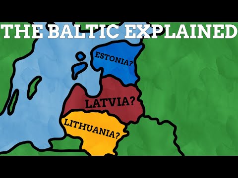
The Baltic Sea explained

preview_player
Показать описание

Learn about the fascinating geography, the intricate geological past, and the ambitious engineering projects around the Baltic Sea in Northern Europe!

More videos about the Baltic Sea:

Chapters:
0:00 intro
0:34 Geography
4:16 Geological History
9:17 Infrastructure

Check out his profile for more incredible maps!

Subscribe for more videos like this one, cheers.

Any support is greatly appreciated!
Рекомендации по теме
Комментарии
Автор

@8:16 - I laughed at this time stemp, as those are golden raisins, not chunks of amber.

Abiesbracteata
Автор

Usually, in school, the geological history of the Baltic Sea, the world's largest inland brackish sea, starts with the end of the ice age about 10-15 KA and tells about its different stages before it became the current sea about 4, 000 years ago.

However, the geological history of the Baltic Sea is much, much older and began when the Baltic plate subducted against the Laurentia (North American) plate around 400-450 Ma. At that time, the western Scandian orogeny and the central plate depression were born on the plate, which became important millions of years later. But from the Cambrian period to the Silurian period, there was a shallow sea in the middle of the Baltic plate, which began to be filled by erosion from sediments from the Scandian mountains.

During the Cretaceous period, based on the discoveries in Kristianstad basin 86.3-71.3 Ma, there were dinosaurs such as theropods, leptoceratopsids, hypsilophodonts, hadrosaurids, iguanodontids and hesperornitheans who roamed the area as well as pterosaurs, mosasaurs, tylosaurs, plesiosaurs and crocodiles. In addition, there were two local meteor impacts, one on Dellen (~89 MA) and a later one on Lappajärvi (~78 MA) before the more famous K-Pg event.

Around 40 MA, by the Eocene period, a wide plain had formed at the site of the more ancient depression. The plain was dominated by the amber-producing coniferous forest that covered it and through it flowed the "Baltic River System" now called as Eridanos. This Eridanos river ran along the previously mentioned depression to the Polish coast and later to the coast of the Netherlands because the river pushed its delta forward and the sea level also started to drop.

Then began the Quaternary ice ages 475-370 KA (Elster, Saale and Weichselian, and between them the interglacials Holstein and Eem) and the glacier scooped out the old river bed several times. And between those ice ages it was filled with water like, for example, the Eemian Sea during the Eemian interglacial period about 127 KA.

That would sum up the usually untold part of the geological history of the Baltic Sea.

danielmalinen
Автор

Why do people still shill for betterhelp after it's been proven to be shitty. Do some research before accepting a sponsor please

bobsmith
Автор

Great video, but damn the loud cut at 2:53 scared the hell out of me

julianjazz
Автор

Surprised no mention of Hanseatic League.

fatviscount
Автор

8:17 did you just show a picture of raisins and said this is amber?

juliusbernotas
Автор

Peculiar that you used the Danish names for all the islands, except for Sjælland where you used the English Zealand.

SIC
Автор

are we sure that are amber pieces at 8:18 an not just raisins?

karlhugentobler
Автор

0:48 I’d say Kattegat north of the Danish straits is considered to be a bay of the North Sea and not a part of Baltic Sea. The salinity is completely different from the salinity in the Baltic Sea.

rhoddryice
Автор

Please stop promoting Better Help. They are not a good company and sell your information (ALL OF IT)

SquishyOfCinder
Автор

11:14 your Areal footage does not show the Kiel Canal in Germany, but the Nordslzeecanal in the Netherlands.

IANinALTONA
Автор

Thank you for the info. I got to experience a bit if the Baltic by riding the ferry from Helsinki to Tallin. Then while in Lithunia on the spit we got so close to the Russian border one phone thought we were in Russia.

noodengrthree
Автор

Great comments and superb video!
I like very much your animation (time line bar and map including a black line showing the shoreline).

denisrho
Автор

Kattegat and the straits of Denmark, are not the Baltic sea. The International Hydrographic Organization defines the limits of the Baltic Sea as follows:
Bordered by the coasts of Germany, Denmark, Poland, Sweden, Finland, Russia, Estonia, Latvia, and Lithuania, it extends north-eastward of the following limits:
In the Little Belt. A line joining Falshöft (54°47′N 9°57.5′E) and Vejsnæs Nakke (Ærø: 54°49′N 10°26′E).
In the Great Belt. A line joining Gulstav (South extreme of Langeland Island) and Kappel Kirke (54°46′N 11°01′E) on Island of Lolland.
In the Guldborg Sound. A line joining Flinthorne-Rev and Skjelby (54°38′N 11°53′E).
In the Sound. A line joining Stevns Lighthouse (55°17′N 12°27′E) and Falsterbo Point (55°23′N 12°49′E).

Hansen
Автор

Not the jump scare at 2:53 haha, almost fainted. Great video tho

cesarrivera
Автор

Fascinating video, love from Kenya 🇰🇪

williswameyo
Автор

Great information about the Baltic and adds greatly to my own knowledge, thanks 👍

johnking
Автор

Also, there is Volgo-Balt channel connecting Volga river and the Baltic. It connects Baltic with Caspian sea and with Volgo-Don channel - with Black sea

petkasyromolotov
Автор

There is system of dams near St Petersburg that close eastern part of Gulf of Finland during storms. I think it is very cool engineering structure

knihnik
Автор

Excellent. I'd have liked to learn a bit more about the salinity and resulting ecology, plus the bathymetry, but that's just me. I did learn loads and thank you.

stco