filmov
tv
How to extract coordinates (Easting, Northing, Elevation) of any point |Using Google Earth
Показать описание
Welcome to the educational world...!
In this video we will talk about how we can get coordinates of any point/location using google earth and global mapper. Actually, we need coordinates of a point when we don't perform physical survey and for desk study or reconnaissance we use latitude and longitudes coordinates obtained from Google Maps or Google Earth.
1) What is Google Earth?
Google Earth is a computer program that renders a 3D representation of Earth based primarily on satellite imagery. The program maps the Earth by superimposing satellite images, aerial photography, and GIS data onto a 3D globe, allowing users to see cities and landscapes from various angles.
How to download google earth pro?
2) What is Global Mapper?
Global Mapper is a geographic information system software package currently developed by Blue Marble Geo graphics that runs on Microsoft Windows. The GIS software competes with ESRI, Geo Media, Manifold System, and Map Info GIS products.
Click this link for Risa 2D tutorials
Staad Pro tutorials
Windows 10 Installation complete guide
#GoogleEarth#GlobalMapper#THEEDUCATIONALWORLD
 0:18:49
How to extract coordinates (Easting, Northing, Elevation) of any point |Using Google Earth
 0:14:31
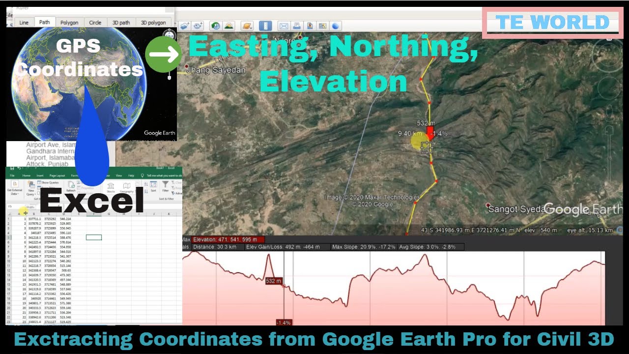
How to Extract UTM Coordinates (Eastings and Northings) and Elevation data from Google Earth PRO
 0:01:08
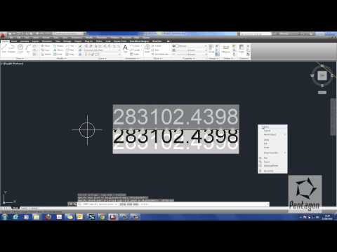
How to insert site coordinates in autocad quickly | Easting and Northing
 0:04:30
Importing Excel Coordinates to ArcMap and Plotting
 0:04:32
How to convert Longitude/Latitude to Easting/Northing in ArcGIS
 0:05:17
How to Generate Easting, Northing (UTM) Coordinates In Qgis
 0:04:21
Creating Easting and Northing Coordinates in AutoCAD
 0:03:16
CadTools Tutorial, Extracting IPs, Easting and Northing Co-ordinates of Alignment, X & Y Coordin...
 0:02:30
How to import Easting and Northing Co-ordinates from Excel to AutoCAD
 0:03:43
How to display northing and easting in AutoCAD
 0:04:04
How to convert Lat Long to Northing and Easting
 0:06:48
How to display Northing Easting and Elevation Without AutoLisp.
 0:13:05
How to convert Longitude/Latitude to Easting/Northing in ArcMap | Convert lat/long To UTM
 0:00:53
Change coordinates to Easting Northing format
 0:02:44
How to Export Coordinates | Easting & Northing | XY Data from AutoCAD to Excel | AutoLisp Comman...
 0:06:17
Google Earth _____ How to find Zone, northing and easting of a Point.
 0:07:04
How to convert Lat Long to UTM (Easting,Northing) | by QGIS Software (English)
 0:10:26
Coordinates (Easting Northing) with table in Autocad 2020 and export to excel file.
 0:05:47
How to convert Northing and Easting to latitude and longitude in civil 3d in Urdu/Hindi
![[GIS] Convert Latitude](https://i.ytimg.com/vi/sc4kO4Qvm5E/hqdefault.jpg) 0:09:09
0:09:09
[GIS] Convert Latitude and Longitude To Northing Easting | XY Coordinate using offline sotware
 0:06:01
Importing CSV (Excel) Coordinates into QGIS
 0:06:56
How display Easting, Northing and Elevation on any object or point without Lisp in AutoCAD & 3D
 0:12:41
How to Convert WGS-84 Lat/Long to UTM: Easting, Northing using QGIS
 0:05:35
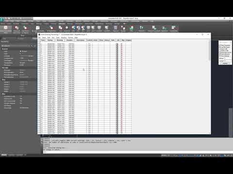
Autocad Data Extraction from Drawing ,Northing ,Easting TABLE #COORDINATE#coordinategeometry
Комментарии