filmov
tv
An ancient ocean in Ice Age Eurasia: Every 5 years

Показать описание
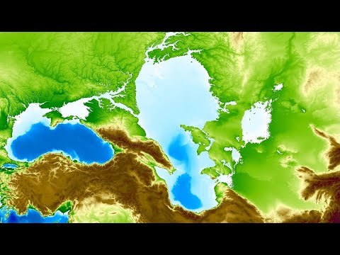
During the Ice Age, an ocean lasted during 50,000 years in Eurasia. One human could going down the Danube river from Germany, to reach Himalaya, or Arctic Ocean or Baikal lake using the greatest hydrological basin of all time.
When three inner seas were an unique paleo-ocean.
Modelling performed on Rstudio
--------------------------------------------------
SOURCES:
West Siberian ice-dammed lake :
Aral Sea paleolevel :
Caspian Sea paleolevel:
Black Sea paleolevel :
Global sea-level :
--------------------------------------------
Other Paleo Mapping videos
Soundtrack :
Elite Dangerous - exploring imperial space
Vortex Mechanics - Saturn rings travelers
 0:07:13
An ancient ocean in Ice Age Eurasia: Every 5 years
 0:00:35
Watch A Camera Drop Into A Hole Beneath Antarctica
 0:00:51
A Bizarre Discovery in Antarctica | Unveiled
 0:01:01
Shocking Discovery In Antarctica #shorts
 0:49:59
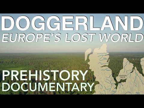
How Doggerland Sank Beneath The Waves (500,000-4000 BC) // Prehistoric Europe Documentary
 0:00:19
Average Height of ANTARCTIC ICE🥶❄️
 1:07:17
Scientists Discovered An Ancient Civilization Frozen In Ice That Shouldn't Exist
 0:00:06
STOP Ignoring These Mysterious Sea Creatures!
 0:02:51
Russian Scientists Found This In Antarctica. #antarctica #shockingfacts #factshorts #viralshort
 0:00:48
4 strangest things that have been found frozen in ice
 0:25:54
This Prehistoric Ocean Was Thalassophobia On Steroids
 0:00:55
This Man Got Lost Under The Ice
 0:00:52
The Oldest Creature on Earth 😲
 0:00:26
Found a Frozen Dinosaur under the ice! How did it get there?
 0:51:57
David Attenborough | Monterey Bay | Deep Ocean | Life in the Abyss
 4:02:53
Time Travel to Prehistory: Ancient Oceans, Ice Age, Neolithic... (ASMR Story for Sleep)
 4:36:15
Ancient Civilizations of the World: Drain the Oceans | MEGA EPISODE | National Geographic
 0:05:23
Why No One's Allowed To Explore The Antarctic
 0:00:38
The Craziest Thing Found Frozen In Ice 🤯
 0:00:58
What’s Hidden Under Antarctica? 🤔
 0:00:15
When you bring a friend to try glacier water on tour with @alpineairalaska & Morgan Lauren 🧊😍...
 0:05:07
Pyramids Found Beneath Antarctic Ice | The UnXplained (Season 3)
 0:00:12
Well-preserved Ice Age animals 😱
 0:11:56
That Time the Mediterranean Sea Disappeared
Комментарии