filmov
tv
Geosoft Oasis Montaj - How to Added Grid Maps

Показать описание
Geosoft Oasis Montaj - How to Added Grid Maps
Geosoft Oasis Montaj is a comprehensive software suite designed for geoscientific data processing, visualization, and analysis. It provides tools for handling various types of geological and geophysical data, including airborne and ground surveys, satellite imagery, seismic data, and more.
Oasis Montaj offers a range of capabilities to support exploration and research in the earth sciences. It allows users to import, manage, and quality control large datasets, perform advanced data processing and interpretation, create custom maps and 3D visualizations, and generate reports.
Some of the key features of Oasis Montaj include:
1. Data Import and Management: The software enables easy importing and organization of different data formats, allowing users to efficiently handle large datasets. It includes tools for managing metadata and data quality control.
2. Data Processing and Interpretation: Oasis Montaj provides a wide range of tools for processing and analyzing geoscientific data. It offers algorithms for filtering, gridding, interpolation, and statistical analysis. Users can apply different processing techniques to enhance and interpret the data.
3. Geophysical Inversion: The software includes advanced inversion capabilities for estimating subsurface properties based on geophysical data. It allows users to model and invert potential field, electromagnetic, and seismic data using various inversion algorithms.
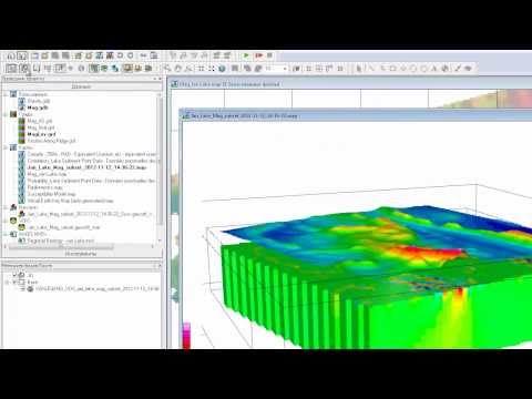
4. 3D Visualization and Modeling: Oasis Montaj allows users to create detailed 3D visualizations of geoscientific data. It supports the construction of geological models and offers tools for 3D visualization, including contouring, slicing, and cross-sectioning.
5. Geospatial Analysis and GIS Integration: The software supports geospatial analysis by integrating geographic information system (GIS) functionality. Users can perform spatial analysis, overlay multiple datasets, and create custom maps.
6. Geophysical Data Processing: Oasis Montaj offers specialized tools for processing and analyzing different geophysical data types, such as magnetic, gravity, electromagnetic, and resistivity data. It includes filters, transformations, and advanced processing techniques to enhance the data for interpretation.
7. Geological Interpretation: The software provides tools for geological interpretation, allowing users to analyze and extract geological information from various datasets. It enables the identification of geological structures, lithological units, and geological boundaries.
8. Geospatial Analysis: Oasis Montaj incorporates various geospatial analysis capabilities. It allows users to perform spatial operations like buffering, intersection, and spatial querying. This enables the integration and analysis of multiple datasets with spatial context.
9. Geostatistics: The software includes tools for geostatistical analysis and modeling. Users can perform variogram analysis, kriging interpolation, and geostatistical simulation to estimate values and uncertainties in spatial datasets.
10. Time-Series Analysis: Oasis Montaj supports the analysis of time-series data, such as seismic and geodetic data. Users can apply temporal filtering, trend analysis, and spectral analysis techniques to extract information and detect patterns in the data.
11. Customization and Automation: The software provides scripting capabilities, allowing users to automate workflows, create custom processing routines, and extend the functionality of Oasis Montaj. It supports languages like Python and VBScript for scripting purposes.
12. Collaboration and Data Sharing: Oasis Montaj offers features for collaboration and data sharing within teams or across organizations. It supports the import and export of various data formats, ensuring compatibility with other software platforms used in the industry.
13. Reporting and Visualization: The software allows users to create professional reports and presentations using customizable templates. It offers interactive visualizations, including graphs, charts, and maps, to communicate analysis results effectively.
Geosoft Oasis Montaj is widely used in the geoscience and mining industries for exploration, resource assessment, environmental studies, and geotechnical analysis. Its extensive capabilities and user-friendly interface make it a valuable tool for geoscientific professionals working with diverse datasets and analysis requirements.
Overall, Geosoft Oasis Montaj is a powerful tool for geoscientists, providing them with a wide range of capabilities to process, analyze, interpret, and visualize geoscientific data. It is commonly used in industries such as mineral exploration, environmental monitoring, geotechnical engineering, and geological research.
#geology #engineering #lecture #creative #magnetic #arcgis #geophysic #eletric #geosoft
Geosoft Oasis Montaj is a comprehensive software suite designed for geoscientific data processing, visualization, and analysis. It provides tools for handling various types of geological and geophysical data, including airborne and ground surveys, satellite imagery, seismic data, and more.
Oasis Montaj offers a range of capabilities to support exploration and research in the earth sciences. It allows users to import, manage, and quality control large datasets, perform advanced data processing and interpretation, create custom maps and 3D visualizations, and generate reports.
Some of the key features of Oasis Montaj include:
1. Data Import and Management: The software enables easy importing and organization of different data formats, allowing users to efficiently handle large datasets. It includes tools for managing metadata and data quality control.
2. Data Processing and Interpretation: Oasis Montaj provides a wide range of tools for processing and analyzing geoscientific data. It offers algorithms for filtering, gridding, interpolation, and statistical analysis. Users can apply different processing techniques to enhance and interpret the data.
3. Geophysical Inversion: The software includes advanced inversion capabilities for estimating subsurface properties based on geophysical data. It allows users to model and invert potential field, electromagnetic, and seismic data using various inversion algorithms.
4. 3D Visualization and Modeling: Oasis Montaj allows users to create detailed 3D visualizations of geoscientific data. It supports the construction of geological models and offers tools for 3D visualization, including contouring, slicing, and cross-sectioning.
5. Geospatial Analysis and GIS Integration: The software supports geospatial analysis by integrating geographic information system (GIS) functionality. Users can perform spatial analysis, overlay multiple datasets, and create custom maps.
6. Geophysical Data Processing: Oasis Montaj offers specialized tools for processing and analyzing different geophysical data types, such as magnetic, gravity, electromagnetic, and resistivity data. It includes filters, transformations, and advanced processing techniques to enhance the data for interpretation.
7. Geological Interpretation: The software provides tools for geological interpretation, allowing users to analyze and extract geological information from various datasets. It enables the identification of geological structures, lithological units, and geological boundaries.
8. Geospatial Analysis: Oasis Montaj incorporates various geospatial analysis capabilities. It allows users to perform spatial operations like buffering, intersection, and spatial querying. This enables the integration and analysis of multiple datasets with spatial context.
9. Geostatistics: The software includes tools for geostatistical analysis and modeling. Users can perform variogram analysis, kriging interpolation, and geostatistical simulation to estimate values and uncertainties in spatial datasets.
10. Time-Series Analysis: Oasis Montaj supports the analysis of time-series data, such as seismic and geodetic data. Users can apply temporal filtering, trend analysis, and spectral analysis techniques to extract information and detect patterns in the data.
11. Customization and Automation: The software provides scripting capabilities, allowing users to automate workflows, create custom processing routines, and extend the functionality of Oasis Montaj. It supports languages like Python and VBScript for scripting purposes.
12. Collaboration and Data Sharing: Oasis Montaj offers features for collaboration and data sharing within teams or across organizations. It supports the import and export of various data formats, ensuring compatibility with other software platforms used in the industry.
13. Reporting and Visualization: The software allows users to create professional reports and presentations using customizable templates. It offers interactive visualizations, including graphs, charts, and maps, to communicate analysis results effectively.
Geosoft Oasis Montaj is widely used in the geoscience and mining industries for exploration, resource assessment, environmental studies, and geotechnical analysis. Its extensive capabilities and user-friendly interface make it a valuable tool for geoscientific professionals working with diverse datasets and analysis requirements.
Overall, Geosoft Oasis Montaj is a powerful tool for geoscientists, providing them with a wide range of capabilities to process, analyze, interpret, and visualize geoscientific data. It is commonly used in industries such as mineral exploration, environmental monitoring, geotechnical engineering, and geological research.
#geology #engineering #lecture #creative #magnetic #arcgis #geophysic #eletric #geosoft
 0:04:24
 0:07:41
 0:06:40
 0:13:30
 0:05:22
 0:05:31
 0:03:42
 0:04:12
 0:08:25
 0:02:52
 0:13:20
 0:18:48
 0:04:45
 0:10:19
 0:03:04
 0:10:38
 0:22:00
 0:26:52
 0:01:36
 0:03:40
 0:02:34
 0:02:14
 0:02:51
 0:18:17