filmov
tv
Ep 37: Navigation: Basic Plotting Part 1

Показать описание
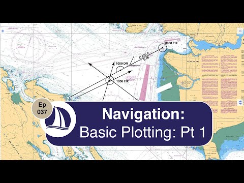
Welcome to Episode 37 of Carpe Diem Sailing. In this video, part 1 of Basic Plotting I take you through plotting a fix or known position, then plotting a Dead Reckoning course followed by another fix and then finally I confirm the fixes with GPS.
SHOWNOTES
CARPE DIEM SAIL TRAINING
LEARN TO SAIL PLAYLIST
COASTAL NAVIGATION by DOMINIQUE PRINET
BOATER'S BOWDITCH: THE SMALLL CRAFT AMERICAN NAVIGATOR
THE ANNAPOLIS BOOK OF SEAMANSHIP
SMALL CRAFT PILOTING AND NAVIGATION
SHOWNOTES
CARPE DIEM SAIL TRAINING
LEARN TO SAIL PLAYLIST
COASTAL NAVIGATION by DOMINIQUE PRINET
BOATER'S BOWDITCH: THE SMALLL CRAFT AMERICAN NAVIGATOR
THE ANNAPOLIS BOOK OF SEAMANSHIP
SMALL CRAFT PILOTING AND NAVIGATION
 0:23:19
Ep 37: Navigation: Basic Plotting Part 1
 0:08:09
HOW TO PLOT SHIPS POSITION ON A CHART USING LATITUDE AND LONGITUDE
 0:09:35
B&G | Tom Cunliffe | Sailing navigation from the chart table
 0:06:31
Day Skipper theory - Charts the magic of the maps
 0:14:28
Ep 51: Navigation: Basic Plotting Part 2: The Running Fix
 0:05:16
Chartwork Tutorial: Course To Steer
 0:10:37
How to Plot a Course to Steer
 0:12:38
Learn to Sail - Basic navigation #1
 0:05:38
How To Use A Navigation Plotter For Private Pilots
 0:52:45
The Sextant in Practice: Sun-Run-Sun explained
 0:05:15
How to plot a GPS-derived fix on a paper chart
 0:03:19
Basic Plotting from A to B
 0:03:37
plotting latitude and longitude using a portland Plotter
 0:14:11
Chart Plotting Exam 9 (3-Bearing Fix) and 10 (Estimated Time of Arrival)
 0:02:07
Navigation Paralle Ruler for Nautical Charts
 0:35:37
Navigation Preparations for an Advanced Coastal Cruise
 0:04:46
Basic Navigation
 0:15:18
Protractor Triangle for Paper Chart Plotting
 0:00:36
How Cast Saws Don’t Hurt Your Skin 🤔
 0:01:57
How to Use the Fastest Plotting Tool in Sailing Navigation
 0:03:27
How to Plot Ship's Position, Course and Distance using Nautical Charts
 0:00:34
Chartwork - Coastal navigation - Leeway Beam Bearing
 0:04:18
Plotting Latitude & Longitude Lines
 0:14:07
Ep 39: Understanding Navigational Aids
Комментарии