filmov
tv
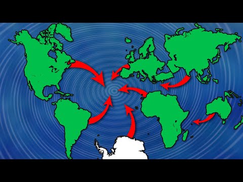
Animated Maps: Tectonic Plate Movement

Показать описание
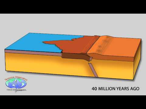
This set of 41 paleo-elevation models (DEM) represents the changing paleogeography of the oceans and continents back to 540 million years ago (Cambrian-Precambrian Period). The snapshots of ancient elevation and bathymetry, based on the interpretation of the rock record, were estimated for time intervals 5 million years apart. The digital elevation model starts when Pangea split into the supercontinents of Laurasia (northern hemisphere) and Gondwana (southern hemisphere). These two continents subsequently subdivided to form the modern continents and ocean basins. India, which rifted from Gondwana ~100 million years ago collided with Asia to form the Himalaya mountains and Tibetan plateau 50 million years ago. The resolution of the data is 1 geographic degree.
Music: The Wild West by Loya
---------------------------------------------------------------------------------------------------
Follow us on Social Media!
Music: The Wild West by Loya
---------------------------------------------------------------------------------------------------
Follow us on Social Media!
 0:01:28
Animated Maps: Tectonic Plate Movement
 0:01:30
Continental Drift from Pangea to Today
 0:02:07
How Earth Will Look In 250 million Years
 0:02:09
Plate Movement: 200 Million Years Ago to Present Day | California Academy of Sciences
 0:01:40
Scotese Plate Tectonics Paleogeography & Ice ages
 0:00:16
Mountain Building Animation
 0:07:22
Plate Tectonics for Kids | Tectonic plates explained
 0:03:24
Plate Tectonics of the Future World - REMASTERED EDITION
 0:06:48
What Are Tectonic Plates? Our Earth and Its Movements
 0:00:13
Continental Drifting : Pangea to Present time #shorts #earth #pangea #continental #drift #space
 0:00:18
Animation: How the next supercontinent will form
 0:19:36
Africa is Splitting into Two Continents and Most People Are Not Aware
 0:00:32
Pangea is BACK! 🌍
 0:06:54
What Is Pangaea & Plate Tectonic? | CONTINENTAL DRIFT | The Dr Binocs Show | Peekaboo Kidz
 0:06:30
Plate tectonics, Paleogeography, & Ice Ages (dual hemispheres)
 0:13:21
What Did Pangaea Look like?
 0:03:19
Earth 100 Million Years From Now
 0:01:15
Formation of Himalayas HD
 0:04:20
1.5 billion years of Plate Tectonics by C.R. Scotese
 0:02:30
Future Plate Tectonics: Pangea Proxima - Vignette 10
 0:00:56
Animation: Continents collide and break apart over time
 0:02:37
Plate Tectonics Explained
 0:09:13
Why Will East Africa Break Up and Merge With India | Geopolitics | Geopolipedia
 0:00:14
A new ocean is forming in Africa Africa is witnessing the birth of a new ocean 60km crack opened u
Комментарии