filmov
tv
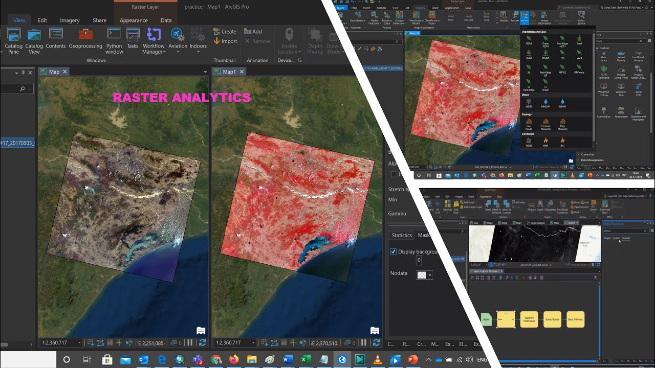
Raster Analytics in ArcGISPro
Показать описание
This lecture mainly covers how to process raster satellite image in fast way. In this lecture we will also cover opening satellite image, FCC conversion, apparent reflectance calculation, spectral band extraction, Indices, NDWI, Image targetting and finally model creation and tool generation in ArcGIS Pro. ArcGIS Pro is very powerful software for processing of satellite image. All the manual step to process raster image can able to convert in a model in just a click. Even that model you can also cover as a tool and share with others so that they can use your tool in their work.
If you like my video, you can also check other video below link is for your reference
SVM classification:
Arcpro building foot print and deep learning tool:
How to track cyclone
Mars Data Analysis in Arc GIS Pro
If you like my video, you can also check other video below link is for your reference
SVM classification:
Arcpro building foot print and deep learning tool:
How to track cyclone
Mars Data Analysis in Arc GIS Pro
 0:15:14
Raster Analytics in ArcGISPro
 0:06:06
Learning ArcGIS Pro: Raster Analysis
 0:06:37
Raster Data Analysis in ArcGIS Pro
 0:58:52
ArcGIS Pro: Analysis Overview
 0:13:45
Performing Change Detection Using Raster Functions in ArcGIS Pro
 0:43:53
Lab8. Raster Data Analysis and Suitability Model in ArcGIS Pro
 0:16:00
Stef's GIS Lab - ArcGIS Pro Tutorial - Basics 10: Raster Analysis
 2:18:56
“Raster and Network Analysis” webinar using ArcGIS Pro software!
 0:03:34
How To Use Raster Calculator in ArcGIS Pro
 0:07:26
ArcGIS Pro - Reclassifying Raster Data
 0:02:40
How To Clip Rasters in ArcGIS Pro
 0:09:10
Exploring the Magic of Raster Functions: A Comprehensive Guide with ArcGIS Pro
 0:12:55
ArcGIS Pro Raster Analysis - RGB to Heat Index
 0:06:18
Image Server: Raster Analytics
 0:03:29
Raster Reclassify in ArcGIS Pro
 0:06:07
ArcGIS and Imagery: Assess Flood Damage with Raster Analytics
 0:03:36
Multidimensional Analysis Using Raster Analytics
 0:33:45
Lab8 Raster Data Analysis in #ArcGIS Pro
 0:57:34
ArcGIS Enterprise: Building Raster Analytics Workflows
 1:10:27
Raster Analytics in Image Server: An Introduction
 0:09:50
Raster Analytics
 0:08:14
Create Multidimensional Rasters from a Collection of Images
 0:18:52
02 (introduction to raster data) Raster analysis in arcgis and arcgis pro
 0:06:06
Get Started with Time-Enabled Data in ArcGIS Pro
Комментарии