filmov
tv
How to map a csv file that has lat/long in QGIS

Показать описание
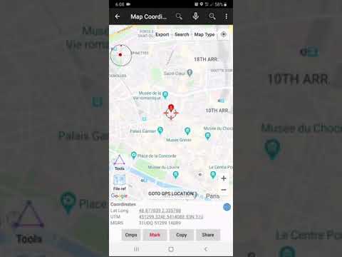
A csv file is just a comma separated text file. If you have a csv with lat/long coordinates in it (e.g. -3.12, 54.67) you can very easily plot these on a map in QGIS with a few clicks.
 0:04:33
 0:01:08
 0:04:01
 0:02:26
 0:02:05
 0:04:02
 0:06:01
 0:08:21
 0:03:52
 0:01:19
 0:05:10
 0:02:53
 0:01:57
 0:01:38
 0:01:25
 0:00:28
 0:01:39
 0:01:56
 0:10:15
 0:08:46
 0:06:26
 0:00:25
 0:01:11
 0:02:16