filmov
tv
Assessing Hurricane Ida Using NASA's GPM IMERG Image Service with GIS Tools (Part 1)
Показать описание
Part 1: Jupyter Notebooks
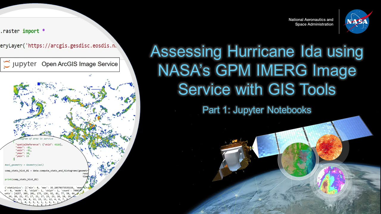
This video describes a step-by-step process on how to view an online image service, and create a custom analytical workflow using that image service within a Jupyter Notebook environment. The code is written in the Python programming language. The tool in this demonstration imports the raster tools needed to run the code, specifies the image service, displays the image service, and runs raster functions built into the service. NASA's Global Precipitation Measurement Mission (GPM) Integrated Multi-satellitE Retrievals for GPM (IMERG) Early Precipitation Rate data, hosted by the NASA Goddard Earth Sciences Data and Information Services Center (GES DISC) ArcGIS Enterprise web portal, is used in this example. For the demo, Hurricane Ida was used as an example where this workflow could be used.
This video describes a step-by-step process on how to view an online image service, and create a custom analytical workflow using that image service within a Jupyter Notebook environment. The code is written in the Python programming language. The tool in this demonstration imports the raster tools needed to run the code, specifies the image service, displays the image service, and runs raster functions built into the service. NASA's Global Precipitation Measurement Mission (GPM) Integrated Multi-satellitE Retrievals for GPM (IMERG) Early Precipitation Rate data, hosted by the NASA Goddard Earth Sciences Data and Information Services Center (GES DISC) ArcGIS Enterprise web portal, is used in this example. For the demo, Hurricane Ida was used as an example where this workflow could be used.
 0:07:19
 0:09:43
 1:13:38
 0:08:04
 0:04:48
 0:00:16
 0:45:31
 1:21:43
 0:59:51
 0:01:57
 0:43:45
 1:11:51
 0:32:21
 0:08:05
 0:03:46
 0:59:12
 0:50:02
 1:02:51
 0:35:58
 1:09:06
 3:27:04
 0:45:57
 1:02:02
 0:00:54