filmov
tv
Using NASA Earth Observations to Visualize Weather Impacts

Показать описание
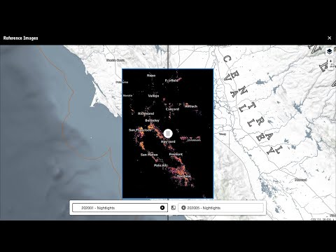
NASA Earth science data helps us to map the connections between our planet’s vital processes and the effects of ongoing climatic changes. Learn how to use NASA’s Global Precipitation Measurement IMERG ArcGIS Image Service for visualizing precipitation rates as well as employing raster functions to enhance utilization of the underlying data during a tropical storm. Join us to learn about our Earthdata resources available to help get you started with learning about using NASA data in GIS tools.
--------------------------------------------------------------------------------------------------------------------------
Follow us on Social Media!
--------------------------------------------------------------------------------------------------------------------------
Follow us on Social Media!
 0:08:04
 0:14:28
 0:08:12
 1:29:42
 0:07:47
 0:08:17
 0:03:45
 0:57:26
 0:00:45
 1:58:44
 0:03:38
 2:44:55
 0:01:56
 2:58:10
 0:07:28
 0:43:36
 0:03:32
 0:01:00
 0:01:07
 0:06:12
 0:46:35
 1:37:37
 0:09:08
 0:11:51