filmov
tv
ICESat-2 Adds the Third Dimension to Earth

Показать описание
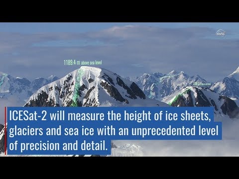
ICESat-2 will provide scientists with height measurements that create a global portrait of Earth's third dimension, gathering data that can precisely track changes of terrain including glaciers, sea ice, forests and more. The single instrument on ICESat-2 is ATLAS, the Advanced Topographic Laser Altimeter System, will measure melting ice sheets and investigate how this effects sea level rise, investigate changes in the mass of ice sheets and glaciers, estimate and study sea ice thickness, and measure the height of vegetation in forests and other ecosystems worldwide. "Eternal Circle," Laurent Dury, Koka Media SACEM Complete transcript available.
Credit: NASA’s Goddard Space Flight Center/Scientific Visualization Studio
Follow NASA’s Goddard Space Flight Center
Credit: NASA’s Goddard Space Flight Center/Scientific Visualization Studio
Follow NASA’s Goddard Space Flight Center
 0:00:56
ICESat-2 Adds the Third Dimension to Earth
 0:01:56
ICESat-2 Elevates Our View of Earth
 0:01:01
How ICESat-2 Elevates Our View of Earth
 0:02:07
ICESat-2 explained
 0:02:58
AGU Cinema: NASA’s ICESat-2
 0:00:38
ICESat-2 By the Numbers: 0.2
 0:00:37
ICESat-2 By the Numbers: 300 Trillion
 0:02:15
ICESat-2 orbit
 0:07:13
Trees, ICESat-2, Lasers, and Open Altimetry
 0:01:33
ICESat-2 Celebrates One Year for Photon Phriday
 0:09:59
Measuring Tree Height ICESat-2, the GLOBE Program, and the Open Altimetry Online Tool
 0:01:08
ICEsat-2: measuring changes to Earth's ice
 0:00:44
ICESat-2 Por Los Números: 1,387
 0:01:49
Introduction to ICESat-2
 0:06:49
Launchpad: ICESat-2 - Next Generation Technology
 0:00:35
New Satellite ICESAT-2 / ICE /CLOUD /LAND ELEVATION
 0:00:40
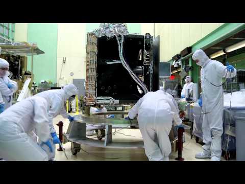
ICESat-2's Instrument on the Move
 0:05:30
ICESat-2 Launches, Promising New Era of Glaciology and Polar Oceanography
 0:11:02
IceFlow: Harmonizing NASA ICESat, IceBridge, and ICESat-2 data
 0:00:24
ICEsat-2 - to measure ice cover on Earth (NASA/USA) - BBC Breakfast News - 15th September 2018
 0:04:41
Our World: ICESat-2 Measures Ice Sheets
 0:00:44
ICESat-2 Por Los Números: 0.2
 0:54:41
Dr. Tom Neumann | ICESat 2 Measuring the Height of the Earth One Photon at A Time
 0:04:52
ICESat-2 deployment
Комментарии