filmov
tv
ICESat-2 deployment

Показать описание
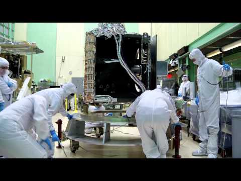
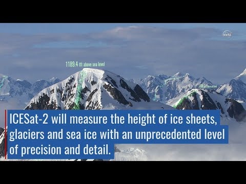
The Ice, Cloud and land Elevation Satellite-2, or ICESat-2, was successfully deployed approximately 53 minutes after being launched by United Launch Alliance’s final Delta II rocket (7420-10C) from Space Launch Complex-2, Vandenberg Air Force Base, California, on 15 September 2018, at 13:02 UTC (06:02 PDT; 09:02 EDT). The Ice, Cloud and land Elevation Satellite-2, or ICESat-2, has a single instrument, the Advanced Topographic Laser Altimeter System, or ATLAS, to measure the elevation of ice sheets, sea ice, forests and more in unprecedented detail.
Credit: NASA
#DeltaII #ICESat2
Credit: NASA
#DeltaII #ICESat2
 0:04:52
ICESat-2 deployment
 0:00:16
ICESat2 ATLAS Telescope Door Deploy Impact Test
 0:00:37
ICESat-2 By the Numbers: 300 Trillion
 0:00:58
NASA's ICESat-2 Separates from Upper Stage
 0:00:36
ICESat-2 By the Numbers: 90
 0:02:29
NASA’s ICESat-2 Mission - 10 Awesome Facts
 0:00:41
ICESat-2 By the Numbers Orbits
 0:00:55
ICESat-2, Delta II Countdown Poll
 0:00:37
ICESat-2's Instrument Lifted from Space-Simulating Chamber
 0:01:01
How ICESat-2 Elevates Our View of Earth
 0:07:13
Trees, ICESat-2, Lasers, and Open Altimetry
 0:02:02
ULA Delta II - NASA ICESat 2 - Highlight
 0:04:46
Delta-2/ ICESat-2 Final Deployment In Polar Sun Synchronous Orbit #ULA #DELTA2FOREVER
 0:00:23
ICESat-2 Sea Ice Thickness 2023
 0:00:40
ICESat-2's Instrument on the Move
 0:06:49
Launchpad: ICESat-2 - Next Generation Technology
 0:01:41
ICESat-2 Testing and Integration B roll
 0:01:59
ICESat-2 Overview
 0:15:44
ICESat-2 Hackweek 2022: Project Presentation - Calculating Grounded Ice Flux
 0:03:17
ATLAS Structure Put Together for ICESat-2
 0:00:56
ICESat-2 Adds the Third Dimension to Earth
 0:13:13
ICESat-2 Data in OpenAltimetry
 0:03:34
The final Delta II rocket ready to launch ICESat-2
 0:05:37
Blastoff! NASA’s ICESat-2 Mission Launches Atop Last Delta II Rocket
Комментарии