filmov
tv
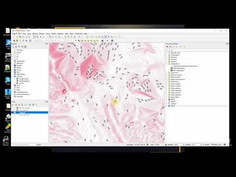
QGIS Create DEM

Показать описание
Create DEM
Data
1.Point Z Value
2. Boundary
Step
1. Add Point Layer
2. Create DEM Using QGIS Pluing SAGA (Interpolate (Natural neighbor))
3. Save As to GeoTiff
Data
1.Point Z Value
2. Boundary
Step
1. Add Point Layer
2. Create DEM Using QGIS Pluing SAGA (Interpolate (Natural neighbor))
3. Save As to GeoTiff
 0:07:05
How to create DEM MAP in QGIS
 0:05:15
Create DEM in QGIS using data from Google Earth Pro
 0:13:02
Generate DEM from contours in QGIS
 0:04:00
Download DEMs in QGIS for a Specified Extent with the OpenTopography DEM Downloader Plugin
 0:16:49
Creating DEM in QGIS # Lesson 17 of 29 #QGIS Tutorial
 0:11:05
Downloading SRTM DEM data using QGIS
 0:06:24
How to Download Digital Elevation Models (DEM) in QGIS [OPENTOPOGRAPHY]
 0:04:38
How to create contours using DEM in QGIS || Generate contours from DEM
 0:02:50
Use Jupyter Lab in your QGIS Python Environment
 0:01:27
Open a Digital Elevation Model (DEM) in QGIS
 0:19:13
How to create 3D Model of DEM image using QGIS
 0:01:44
#35 QGIS - How to add XYZ Files easy into QGIS and convert it into DEM Raster
 0:03:24
QGIS 101: Hillshade from DEM
 0:06:36
QGIS Create DEM
 0:04:26
Generate river network in QGIS || Generate stream network in QGIS
 0:22:28
How to create DEM from Google Earth Image and prepare Contour Mapping in QGIS
 0:18:36
QGIS Import XYZ coordinates data, Create DEM, Create contours, Add Contours label, Use 3D view model
 0:03:43
QGIS - Create Vector Lines from DEM
 0:09:33
Delineate watershed area in QGIS || Delineate catchment area in QGIS
 0:02:13
QGIS Part8 - How to download digital elevation model (DEM)
 0:00:27
How to download DEM data in QGIS #dem #qgis #gis #remotesensing
 0:04:46
QGIS Interpolating to Raster from Points
 0:02:41
How to Create Contours in QGIS from a DEM
 0:08:52
How to Create Elevation Profile from DEM in QGIS
Комментарии