filmov
tv
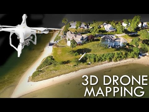
3D Mapping Using A DJI Mavic Air 2S

Показать описание
Learn how to create beautiful 3D models used for solar site assessments and solar design using a DJI Mavic Air2S and Scanifly.
 0:10:27
FINALLY DJI Mini 4 Pro, Mavic 3, and Air 3 Automated 3D Drone Mapping and Photogrammetry
 0:09:46
DJI Mavic 3E Enterprise - Mapping and 3D Modeling Made Easy
 0:18:11
Turn Your DJI Drone Into A Mapping Machine For FREE!
 0:07:25
How to Create a 3D Models from Drone Images with DJI Mini 3 Pro
 0:22:31
Building 3D Topographic Maps with the DJI Mavic Pro - Hak5 2115
 0:03:30
3D Mapping Using A DJI Mavic Air 2S
 0:07:14
DJI Terra 3D Mapping Software - First Look
 0:14:10
Mission Planning Tutorial for DJI Mavic 3 Pro, Mini 4 Pro, and Air 3 for Photogrammetry / 3D mapping
 0:02:04
DJI Terra: Software Terbaik untuk LiDAR & Photogrammetry
 0:38:43
3D modelling with the DJI Mini 3 pro (using photogrammetry)
 0:00:13
DJI Matrice 4E in Action: Mapping Like Never Before 📹 @skydeploy
 0:16:29
DJI Mavic 3 Enterprise - Mapping With DroneDeploy
 0:00:57
Drone Mapping with the DJI Mini 2
 0:04:45
3D MAPPING with a DJI Phantom & Drone Deploy
 0:00:23
Creating a 3D model of a cathedral using a drone ⛪️ DJI Matrice 4E, DJI Terra 🎬@f7digitalgmbh...
 0:12:10
3D Oblique Mapping Using DJI Pilot 2 - Episode 10
 0:05:24
DJI Mavic 3D Mapping Explanation with PIX4D (For Dummies ONLY)
 0:15:05
DJI MINI 2 PHOTOGRAMMETRY WITH THE MAP-CREATOR
 0:14:36
Drone Mapping with DJI Mini 2 Step by Step Guide
 0:15:09
Map for Free with a DJI Mini 3 Pro!
 0:03:58
How to Use DJI Terra's 3D Reconstruction Function
 0:00:40
DJI Mavic 3 Enterprise - RTK Surveying and Mapping Drone
 0:11:42
How to create a map/3D model using a DJI Mini2, Map Pilot Pro (iOS) and WebODM (PC)
 0:00:54
Dji Mavic 3T Mapping in 2d & 3d
Комментарии