filmov
tv
Mapping the Antikythera Shipwreck

Показать описание
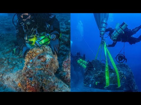
Sirius, the underwater robot, aka. Autonomous Underwater Vehicle (AUV), from the Australian Centre for Field Robotics was used in September 2014 to produce very high resolution 3D digital maps of the Antikythera shipwreck.
This video provides insight into how it was all done.
This will provide a blueprint upon where all future finds and work will be plotted.
This video provides insight into how it was all done.
This will provide a blueprint upon where all future finds and work will be plotted.
 0:05:56
Mapping the Antikythera Shipwreck
 0:00:51
Mapping the Antikythera Shipwreck - Sirius Underwater Robot (AUV) at Work
 0:03:36
THE ANTIKYTHERA SHIPWRECK/ΤΟ ΝΑΥΑΓΙΟ ΤΩΝ ΑΝΤΙΚΥΘΗΡΩΝ (English / Greek)
 0:03:25
Skeleton uncovered at ancient Antikythera shipwreck
 0:03:28
Stunning New Finds on the Antikythera Shipwreck!
 0:04:57
The 2,000-Year-Old Machine That Stunned Archaeologists | BBC Timestamp
 0:31:54
The Secret of the Antikythera Mechanism | The world's oldest computer
 0:10:02
2019 Antikythera Expedition Video
 1:30:08
10 Ancient Mysteries That Still Baffle Scientists!
 1:05:43
'The Antikythera Shipwreck: Excavating the World's Richest Ancient Shipwreck'
 0:13:18
Underwater Archaeology News ~ Black Sea, Egypt, Ballard, Antikythera Device & More
 0:12:26
Lost Ancient Technology: The 2,000-Year-Old Antikythera Computer Found Underwater!!
 0:07:23
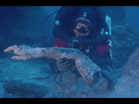
Bronze Arm Found at Antikythera Shipwreck
 1:04:40
Decoding the Heavens: The Antikythera Mechanism by Jo Marchant
 0:11:18
2017 Return to Antikythera Expedition
 0:01:27
Greek Antikythera Shipwreck More Secrets! 5-Year Extension Granted!
 0:03:14
Virtual Model of the Antikythera Mechanism by Michael Wright and Mogi Vicentini
 0:00:43
Ancient Greek Tech: Predicting Eclipses in 150 BC? #AntikytheraMechanism #AncientMysteries
 0:03:29
Scientific American - What Will the Antikythera Shipwreck Skeleton Tell Us
 0:03:40
Head of Hercules and other treasures found on Roman 'Antikythera Mechanism' shipwreck
 0:54:55
Bearded Nerd - Episode 16: Antikythera Mechanism
 0:00:55
5 Mysterious Ancient Artifacts That Still Can’t Be Explained! #ancientartifact #mysteriousartifacts...
 0:00:30
Antikythera Bones
 0:00:53
Antikythera mechanism #india #pakistan #africa #europe #asia #italy #nigeria #world
Комментарии