filmov
tv
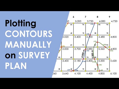
How to Plot CONTOURS on a SURVEY PLAN with REDUCED LEVEL(R.L.) Points/ Interpolation of CONTOURS

Показать описание
# Plotting contours manually on paper when you already have reduced level points from the site survey.
# How to make contour lines with the given reduced level points.
# How to make freehand contour lines on a survey plan.
RELATED VIDEOS :
How to get CONTOUR LINES of any site in SKETCHUP and export it to AUTO CAD in three steps.
How to Convert GOOGLE EARTH to AUTOCAD by TCX converter + QUICK GRID or SURFER (DEM)
Most easy way to get a DWG or DXF file from GOOGLE EARTH using GLOBAL MAPPER (DEM)
TWITTER: arpiyush21
INSTAGRAM: arpiyushpant
 0:12:10
How to Plot CONTOURS on a SURVEY PLAN with REDUCED LEVEL(R.L.) Points/ Interpolation of CONTOURS
 0:07:54
Visualizing Multi-variable Functions with Contour Plots
 0:04:48
Drawing contour lines from grid
 0:03:06
Contours and Contour Plots
 0:09:22
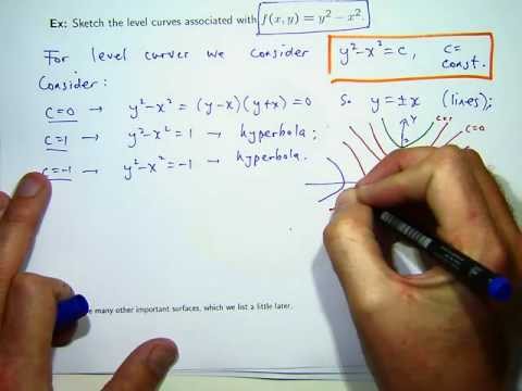
How to sketch level curves
 0:08:03
How to Draw Contour Lines
 0:04:10
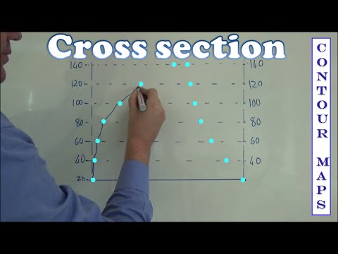
Cross section mapwork / mapping
 0:07:36
How To Draw Contours Using Surfer Software
 0:05:36
Where to Find Free Contour Maps Online
 0:04:57
How to Plot CONTOURS on a SURVEY PLAN with REDUCED LEVEL(R.L.) Points/ Interpolation of CONTOURS.
 0:02:27
Graphing: Origin: Contour Plots and Color Mapping Part 1 - Create Contour Plot from a Matrix
 0:09:12
How to extract contour lines And DEM from Google Earth
 0:06:17
Gradient and contour maps
 0:04:45
Contour Map of f(x,y) = 1/(x^2 + y^2)
 0:13:40
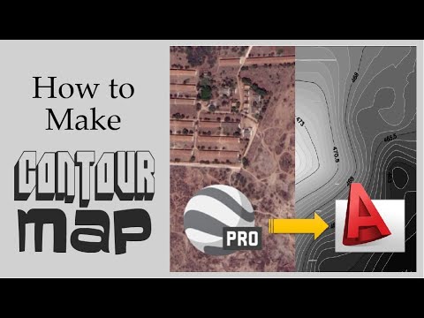
How to make a contour map | Google Earth Pro | Autocad | Step By Step
 0:23:59
Plotting Contours (by Interpolation)
 0:13:25
How to Plot Contours on Survey Plans using surfer software || #contourtutorial for beginners
 0:10:13
HOW TO CREATE CONTOURS | SKETCHUP TUTORIALS FOR BEGINNERS
 0:06:32
Revit Architecture - Extras _ Site Topography _ Contour Lines
 0:06:14
How to Create Contours from a Raster in ArcGIS || Contours Lines from DEM in ArcGIS
 0:10:56
How to Plot Contours on AutoCAD | How to Import points, create contour lines with surface Civil 3D
 0:15:18
Plotting contours
 0:12:04
How to Draw Contours Lines
 0:18:16
Contouring With Example | How to Draw / Trace Contour Lines | Equal Interval Data of RL
Комментарии