filmov
tv
Chaining on uneven ground by direct method || latest surveying equipment ||civil || bLUb || indirect

Показать описание
#blub
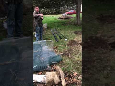
The method consists in measuring the line in short horizontal lengths called steps. Suppose it is required to measure the horizontal distance between the points A and B (Fig. 2.19). For convenience and to obtain better results, chaining is done from top of hill to the toe i.e. downhill.
ADVERTISEMENTS:
The follower holds the zero end of the chain at A on the ground and the leader with the other handle of the chain and a ranging rod moves in the forward direction at a convenient distance apart.
The leader then stops and the follower directs him to be in line with B. The leader then stretches the chain in the horizontal position and transfers the end point of the chain on the ground with the help of a plumb-bob or ordinarily with a ranging rod or by dropping a piece of stone.
The follower then moves and reaches the station occupied by the leader and then the leader moves in the forward direction. The process is repeated for several times until the whole line is chained. The lengths of all the steps are added up so as to obtain the total horizontal distance. In this case, the horizontal distance between AB = Ap + Pq + Qr + Rb.
Chaining on uneven ground by direct method || latest surveying equipment ||civil || bLUb || indirect
 0:05:33
How To Easily Bias Cut Chain Link Fence | Terminating An Uphill Or Downhill Run
 0:02:02
how to install chain link fence on uneven ground
 0:03:13
How To Build a Fence on Uneven Ground
 0:04:24
TAPING ON UNEVEN AND SLOPING GROUND
 0:18:36
Chaining on uneven ground
 0:17:11
Chaining ! Chaining on slopy ground ! Chaining in chain survey ! Direct method ! Steping method
 0:11:16
How to Install a Chain Link Fence
 0:06:59
Want Rock-Solid T-Posts on Sloping Ground? Watch This Now!
 0:21:59
How To Install Chain Link Fence The Easy Way
 0:01:00
Uneven Ground
 0:04:59
How to Install a Chain Link Fence | The Home Depot with @thisoldhouse
 0:00:57
How to get a fence pulled Tight! Like a pro! #shorts
 0:29:41
Chaining on uneven or slopping ground | Part-5| GATE SSC JE Exam
 0:10:34
Setting Chain Link Fence Posts Quickly And Easily | How We Build Chain Link
 0:01:59
How to install tension wire on a chain link fence
 0:02:49
Taping Over Uneven And Sloping Ground
 0:02:18
How To Attach Your Fence To Your House The Right Way
 0:01:18
How Do You Level Posts on Uneven Ground? Fence Guy Answers
 0:18:08
What Is The BEST Way To Stretch Fence Wire? | Chain Strainer VS Come Along
 0:05:57
HOW TO Install Chicken Wire Fence on Uneven Ground - (EASY Garden Fence)
 0:03:40
Set Chain Link Fabric Perfectly Every Time! (EASY)
 0:07:48
Taping on Level Ground and Uneven Ground | Surveying Fieldwork #2
 0:05:10
Problems With Uneven Ground And Straight Fences – Landscaping and Construction Tips
Комментарии