filmov
tv
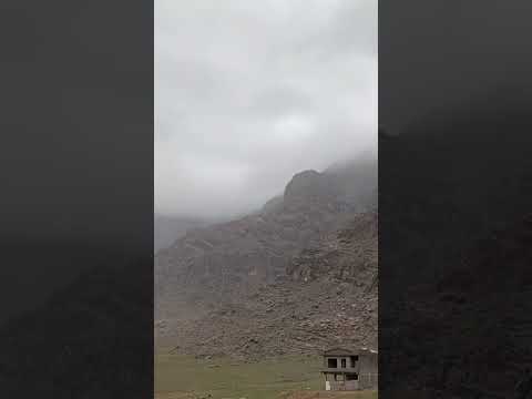
Ur of the Chaldees: Where was it? A Jewish Perspective

Показать описание
This video explores where the potential location of Ur of the Chaldees was according to Jewish tradition. Since the Woolley expedition in the 1920s it has been assumed by most scholars that the city of Ur and the biblical Ur of the Chaldees were synonymous. We will explore alternative sites.
#Abraham #Bible # OldTestament
Follow me on Social Media:
Support the Channel:
I own no rights to copyrighted films and photos, and am using them for educational purposes as defined by fair use laws.
Images:
Description
English: Part of Dead Sea Scroll number 28a (1Q28a) from Qumran Cave 1. From Qumran (Khirbet Qumran or Wadi Qumran), West Bank of the Jordan River, near the Dead Sea, modern-day State of Israel. The Jordan Museum, Amman, Jordan Hashimite Kingdom.
Date 28 January 2018, 15:41:11
Source Own work
Author Osama Shukir Muhammed Amin FRCP(Glasg)
Description British Museum page
English: Sumerian Cylinder Seal of King Ur-Nammu
Date 7 February 2005
Author Steve Harris
Description Apadana Hall, 5th century BC carving of Persian and Median soldiers in traditional costume (Medians are wearing rounded hats and boots)
Source Own work
Author Arad
Description
Türkçe: Bu Sümer uygarlığı döneminde antik Mezopotamya şehir devletlerinin bir haritasıdır.
English: This is a map of the city states of ancient Mesopotamia during the Sumerian civilization.
Date 2 February 2019
Source
No machine-readable author provided. Zunkir assumed (based on copyright claims).
File:Ur3.JPG
Author Hedda Gabler
Description
English: Harran beehive houses
Date 18 June 2012, 07:22:03
Source Own work
Author Zhengan
Description
English: The Hittite Empire, approximate extent of the maximum area of the Hittite rule (light green) and the Hittite rule ca. 1350-1300 BC (green line)
Date 17 September 2013, 20:52:36
Source
This map for the information
Author
derivative work: Ikonact
Description
Tablet on display at the Oriental Institute, with the caption:
Hittite Cuneiform Tablet:
Cultic Festival Script
Baked clay
Hattusha
Late Bronze Age (14th century BC?)
A6007
Description
العربية: أنقاض مدينة أور الأثرية في محافظة ذي قار جنوب العراق
English: Ruins in the Town of Ur, Southern Iraq
Español: Ruinas de la ciuad de Ur con el Zigurat de Ur-Nammu al fondo a las afueras de Nasiriyah.
Ruins
Date 20 June 2006
Source Flickr
Author M.Lubinski from Iraq,USA.
Description Euphrates river
Date Taken on 23 September 2009
Author Alen Ištoković
Description
English: Map of the main cities of Lower Mesopotamia during the Early Dynastic period, with the approximate course of the rivers and the ancient shoreline of the Gulf.
Français : Carte des principales villes de la Basse Mésopotamie durant la période des Dynasties Archaïques, avec le tracé approximatif des fleuves et l'ancien trait de côte du Golfe.
Date 28 September 2010, 12:00 (UTC)
Source
Author
Description Picture of the Şanlıurfa/Urfa skyline.
Date 5 July 2006, 21:51:36
Source Flickr: Şanlıurfa
Author Damien Halleux Radermecker
Description
English: Balikli Göl, Şanlıurfa, Turkey
Français : Balikli Göl, Şanlıurfa, Turquie
Date 24 May 2014
Source Own work
Author Bernard Gagnon
Description
English: Harran beehive houses
Date 18 June 2012, 07:22:03
Source Own work
Author Zhengan
Description
English: A fishing boat in the Euphrates southern Iraq
العربية: قارب صيد محلي في نهر الفرات جنوب العراق في ذي قار
Date 28 December 2015, 09:33:17
Source Own work
Author Aziz1005
Description
English: Euphrates River
Date 21 June 2012, 04:59:31
Source Own work
Author Zhengan
 0:10:47
Ur of the Chaldees: Where was it? A Jewish Perspective
 0:08:51
Ur: A Short History of a Great Sumerian City
 0:10:50
THE MYSTERY ABOUT WHICH PEOPLE ABRAHAM BELONGED TO. WAS ABRAHAM HEBREW? JEWISH? CHALDEAN?
 0:07:26
Dr. Douglas Petrovich - Ur of the Chaldees & Rameses
 0:27:05
Great Ziggurat Of Ur & The Ancient City In Mesopotamia. Birthplace of Abraham? Nasiriyah, Iraq.
 0:44:56
Ur : The Rise and Fall of the Ancient Sumerian City State
 0:12:39
The Rise and Fall of the Sumerian City of Ur
 0:02:11
Discover Ur, Iraq
 0:10:19
CHALDEANS THE BIBLICAL ORIGIN OF ABRAHAM’S PEOPLE
 1:12:55
Ur of the Chaldees
 0:00:31
This is where the land of UR was located.(ancient mesopotamia)
 0:08:50
The Chaldean Mystery
 0:06:29
Abraham's Journey - Interesting Facts
 0:21:19
Finding ur of the Chaldeans
 0:09:22
True reason Abraham left Ur of Chaldean
 0:17:07
The City of Ur
 0:10:10
The Real Ur Of Genesis
 0:03:02
Who are the Ancient Chaldeans?
 0:23:20
Abraham: Biblical Archaeology
 0:14:45
Abraham's Ur. In Turkey or Iraq?
 2:26:25
Lord of Spirits - From Ur of the Chaldeans [Ep. 26]
 0:12:19
Ireland - Ur of the Chaldees - Chapter 1- The Extent Of Chaldea
 0:07:23
UR of Chaldeans: Origins of Mankind ( Sumerians) Abraham
 0:00:19
Ur: The City of Abraham
Комментарии