filmov
tv
Create HMS Project in HEC GEOHMS, Gridded option 17 of 19

Показать описание
Create HMS Project in HEC GEOHMS, Gridded option
HEC-GeoHMS is a GIS extension that provides the user with a set of procedures, tools, and utilities for the preparation of GIS data for import into HEC-HMS and generation of GIS data from HMS output.
The Geospatial Hydrologic Modeling Extension (HEC-GeoHMS) has been developed as a geospatial hydrology toolkit for engineers and hydrologists with limited GIS experience. HEC-GeoHMS uses ArcGIS and the Spatial Analyst extension to develop a number of hydrologic modelling inputs for the Hydrologic Engineering Center's Hydrologic Modeling System, HEC-HMS. ArcGIS and its Spatial Analyst extension are available from the Environmental Systems Research Institute, Inc. (ESRI). Analyzing digital terrain data, HEC-GeoHMS transforms the drainage paths and watershed boundaries into a hydrologic data structure that represents the drainage network. The program allows users to visualize spatial information, document watershed characteristics, perform spatial analysis and delineate subbasins and streams. Working with HEC-GeoHMS through its interfaces, menus, tools, buttons, and context-sensitive online help allows the user to expediently create hydrologic inputs for HEC-HMS.
Chapters:
00:00 The title
00:35 Review of the previous parts
03:06 Finishing working on the PARAMETERS menu by choosing the MUSKINGUM CUNG
04:47 Working on the HMS menu
04:54 DATA MANAGEMENT
05:37 MAP TO HMS UNITS
08:05 CHECK DATA
08:53 HMS SCHEMATIC
10:21 TOGGLE LEGEND
11:16 ADD COORDINATES
11:51 PREPARE DATA FOR MODEL EXPORT
15:31 BACKGROUND SHAPE FILE
15:53 BASIN MODEL FILE
16:57 GRID CELL FILE
18:49 MET MODEL FILE
19:33 CREATE HEC-HMS PROJECT
23:14 Collecting the files that are used in the implementation of the project in one file or folder
HEC-GeoHMS is a 2D/3D mapping software for land, water, and airborne surveys.
Introducing HEC-GeoHMS. A high-quality education in the field of sustainable development, global health, and international affairs.
Download HEC-GeoHMS from the following Website link
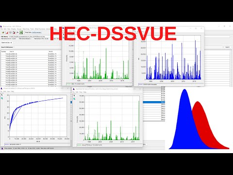
Download HEC-DSSVue from the following Website link
Channel Website link
Channel page Website link
Website
#Advanced_Water_Resources_Engineering
#HEC_GeoHMS
#HEC_HMS
#HEC
#HMS
#HEC_HMS_GRIDDED
#HEC_HMS_CALIPRATION
#HEC_HMS_OPTIMIZATION
#RESERVOIR
#ArcGIS
#DAM
#Dem
HEC-GeoHMS is a GIS extension that provides the user with a set of procedures, tools, and utilities for the preparation of GIS data for import into HEC-HMS and generation of GIS data from HMS output.
The Geospatial Hydrologic Modeling Extension (HEC-GeoHMS) has been developed as a geospatial hydrology toolkit for engineers and hydrologists with limited GIS experience. HEC-GeoHMS uses ArcGIS and the Spatial Analyst extension to develop a number of hydrologic modelling inputs for the Hydrologic Engineering Center's Hydrologic Modeling System, HEC-HMS. ArcGIS and its Spatial Analyst extension are available from the Environmental Systems Research Institute, Inc. (ESRI). Analyzing digital terrain data, HEC-GeoHMS transforms the drainage paths and watershed boundaries into a hydrologic data structure that represents the drainage network. The program allows users to visualize spatial information, document watershed characteristics, perform spatial analysis and delineate subbasins and streams. Working with HEC-GeoHMS through its interfaces, menus, tools, buttons, and context-sensitive online help allows the user to expediently create hydrologic inputs for HEC-HMS.
Chapters:
00:00 The title
00:35 Review of the previous parts
03:06 Finishing working on the PARAMETERS menu by choosing the MUSKINGUM CUNG
04:47 Working on the HMS menu
04:54 DATA MANAGEMENT
05:37 MAP TO HMS UNITS
08:05 CHECK DATA
08:53 HMS SCHEMATIC
10:21 TOGGLE LEGEND
11:16 ADD COORDINATES
11:51 PREPARE DATA FOR MODEL EXPORT
15:31 BACKGROUND SHAPE FILE
15:53 BASIN MODEL FILE
16:57 GRID CELL FILE
18:49 MET MODEL FILE
19:33 CREATE HEC-HMS PROJECT
23:14 Collecting the files that are used in the implementation of the project in one file or folder
HEC-GeoHMS is a 2D/3D mapping software for land, water, and airborne surveys.
Introducing HEC-GeoHMS. A high-quality education in the field of sustainable development, global health, and international affairs.
Download HEC-GeoHMS from the following Website link
Download HEC-DSSVue from the following Website link
Channel Website link
Channel page Website link
Website
#Advanced_Water_Resources_Engineering
#HEC_GeoHMS
#HEC_HMS
#HEC
#HMS
#HEC_HMS_GRIDDED
#HEC_HMS_CALIPRATION
#HEC_HMS_OPTIMIZATION
#RESERVOIR
#ArcGIS
#DAM
#Dem
 0:28:45
 0:12:58
![[HEC-HMS #2] HEC](https://i.ytimg.com/vi/BBW6GuYSQVo/hqdefault.jpg) 0:34:42
0:34:42
 0:43:51
 0:19:29
 0:59:30
 0:37:55
![[HEC HMS #4]COMPLETE](https://i.ytimg.com/vi/6h0MbicK768/hqdefault.jpg) 0:38:43
0:38:43
 0:16:56
 0:15:58
 0:10:51
![[HEC HMS #3]EXPORT](https://i.ytimg.com/vi/jtH1Yt1JlP0/hqdefault.jpg) 0:09:35
0:09:35
 0:01:58
 0:59:58
 0:09:20
 0:09:24
 0:09:22
 0:45:37
 0:45:36
 0:14:57
 0:37:53
 0:34:11
![[HEC HMS #5]](https://i.ytimg.com/vi/WMVSwW2Omyc/hqdefault.jpg) 0:23:37
0:23:37
 0:43:24