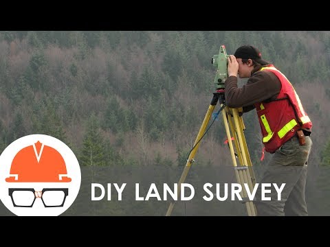
Topographic Surveying for Beginners

preview_player
Показать описание


About Professor Rami Tamimi:
Rami Tamimi is an American doctorate student at The Ohio State University working towards his Doctor of Philosophy in Geodetic Engineering. With over 8 years of experience in the Land Development Industry, his experience revolves around traditional field surveying, civil design work using AutoCAD Civil 3D, and geospatial technology including LiDAR, SONOR, and Photogrammetric data acquisition and processing with the use of Unmanned Aircraft Systems or Drones. He is also a University Professor and creates instructional video content on YouTube.

Intro: (0:00)
Instrument Set Up: (0:22)
Data Collection: (6:13)
Outro: (13:59)

#Surveying #Topographic #TotalStation
Рекомендации по теме
Комментарии
Автор

I'm a Florida Surveyor with over 35 years experience, 29 of those years outside in the field. I'm so happy to see all of your interest in the profession. I had lots of adventures, sometimes fun, sometimes not so much. But always interesting. I have 4 words of advice for you. One, don't get killed, always be aware of your surroundings. Two, don't get sued, meticulous attention to details is of the utmost importance. Three, cover up when out in the sun. It's so hot here in Florida, I neglected my skin and have many scars from the skin cancer being removed. And 4, always take time to enjoy the day, watch the sunrise, listen to the birds, enjoy not being tied to a desk.

wademorris
Автор

when it comes to surveying, you are my king. this is the channel all surveying student have been waiting for. keep it up. much respect sir

MOZENKO
Автор

Not a surveyor but I am a civil EIT working for a local firm in the southwest US. I volunteered to help out the survey guys to get topo shots in one of our projects and I just want to say I completely underestimated the amount of work to get accurate shots. Surveying is physically demanding but it can pretty fun and challenging. Thanks for showing this video!

jamfoxs
Автор

I really appreciate the quality of the videos, thank you for the time you put in these, your editing skills are really impressive.

devancourtright
Автор

I gotta say I will be taking civil engineering next school year as a fresh man and i'm willing to use my time to have a headstart in our lessons. You deserve more recognition sir and thank you for your efforts

marcq
Автор

Just started as a chainman and want to learn as much as I can to become a surveyor. This is so valuable, thank you!

mbopdude
Автор

You've earned the respect of an archaeologist with this kinda content. Now I know how to the survey an archaeological site.

ryancousins
Автор

I am really finding your channel very insightful and you providing a practical way of understanding surveying. Otherwise, I have watched all your videos on your channel so far, probably the one that would help a lot more would be sharing your sample data. So as allow us follow through with your lessons. (MSc. Student, Zambia)

mulolwamulolwa
Автор

Subscribed! Awesome introduction to what it takes to survey!

skadelbai
Автор

Watching from England, while I'm not an engineer I am a salesman of survey equipment, as such there is little to no training for anyone outside of being an surveyor here, so guys like me have to learn the basics on our own, not ideal. Your videos however have proven to be a fantastic resource, so just wanted to say a huge thank you for the video uploads, I especially like the fact you address other units not just the Sokkia one you are using, here in the UK we see a lot more of Topcon & Leica units over the others so short mentions of what other manufacturers may do is a small but valuable touch. Cheers fella.

andycropper
Автор

Thank you for the videos man, keep it up

kevinvallejo
Автор

Gotta love line work! I'm in beautiful east tn.... right at the foothills of the Great smokey mountains. You'd be impressed in the variety of trees we have. We typically pick up trees over a foot and identify them. We have many different trees around here it's insane.

augu_st
Автор

good video. The first data collector I used was a lietz SDR-2. the office software was written by the company I worked for and I had some say in what was included in the software. I have also used a plane table to do a topo

robopup
Автор

Your video is very helpful! The English subtitles are very clear! Wonderful!! Thank you very much!!

mariachoy
Автор

Woow!You are doing an Amazing work Sir.God bless you so much for this enlightenment.

shamaelohimtv
Автор

Hi, Rami. I'm from Brazil and I'm very happy to discover your channel and videos. I'm currently studying cartographic engineering and you will be so helpful to me hahahahah. Thanks and congratulations, guy!

ivesbrandao
Автор

Your info made Topography easy for me thank you 😍

rahimniazi
Автор

Good vidéo👍, a surveyor from France, team Leica.😊

philippeconstantin
Автор

I'm working in different countries as a Senior Surveyor, so I'm happy with my profession.

arcreative_vlogs
Автор

Amazing video. Always continue what you are doing. You are helpful to many.

joeywafu