filmov
tv
How to be a Drone Mapping Pro | Deep Dive

Показать описание
If you want to know more about Drone Mapping & Drone Survey's this is the ultimate guide for you. Dave King breaks down every element of mapping including which drones to use for 2D & 3D maps, which drone equipment to use for Survey work, and what all the work flow processes to consider for Drone Mapping. We review Drone processing software as well as the validation processes that are essential to make sure the drone data collected is as expected.
02:11 Can I create simple 2D or 3D maps easily with my own drone?
02:32 What is Drone Photogrammetry?
02:54 Survey grade accuracy versus Consumer Grade accuracy
04:38 Why some drone cameras are not ideal mapping
06:13 Benefits of RTK GPS
07:00 Benefits of Drone Terrain Following
07:25 What is Ground Sample Distance
08:07 Why Validating the Drone Data is so important
08:50 Introduction to Survey Base stations and why they need reference GEO data
10:14 What is and how to calibrate recorded Rinex data
10:47 Introduction to Drone Ground Control Points
11:44 Recommended practices for GPC’s and cost breakdown
12:18 Difference between Survey base and rovers
13:17 What are Check Points for mapping?
14:30 Limitations of the DJI DRTK2 base station compared to 3rd party base stations
15:45 Complete Price break down for data equipment
16:27 Why we recommend EMLID Reach GNSS Receivers
#dronesurvey
#photogrammetry
#dronemapping
#surveying
#EMLID
#orthomosaic
 0:06:25
How To Fly a Drone - Beginners Guide
 0:13:56
How To Fly A Drone For BEGINNERS - The BASICS
 0:12:22
HOW TO FLY A QUADCOPTER/DRONE FOR BEGINNERS
 0:13:24
How to Fly a Drone (& NOT Crash)
 0:14:19
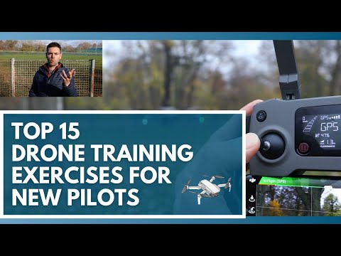
Use These 15 Drone Training Exercises to Learn How to Fly a Drone
 0:02:41
How To Fly a Drone
 0:08:28
10 Incredible Ways To MAKE MONEY With A Drone You NEED to Know
 0:00:18
Learning to be an FPV Drone Pilot
 0:07:26
DJI NEO DRONE RETURN TO HOME ACCURACY TESTING #dji #djineo #4k #drone #camera #flywithneo
 0:07:44
LEARN HOW TO FLY A DRONE IN 7 MINUTES!
 0:00:25
how to make a drone #drone
 0:00:54
Don't buy a DRONE, without watching this! (1/2)
 0:19:22
How To Create and Edit A Drone Video - A Beginner's Tutorial
 0:20:44
Learn How To Fly A Drone | 10 Simple Practice Drills For Beginners + PDF Guide
 0:00:27
【KIDOMO】 F02 Foldable Mini Drone : How to Operate the Mini Drone?
 0:00:59
P8 Drone How To Successfully Bind & Connect To The Camera
 0:08:38
Starting a Drone Business? - 5 years advice in 10 minutes
 0:04:13
LEARN HOW TO FLY A DRONE IN 4 MINUTES!
 0:15:06
4 Tips for New Drone Pilots - Less Stress, More Fun!
 0:05:28
Behind the scenes - How to make a drone show
 1:02:01
Drone Filmmaking Beginners Guide - How To Fly a Drone
 0:10:21
HOW TO Fly a Drone - Back to Basics (Episode 1)
 0:30:49
50 DRONE TIPS From Beginner to Pro
 0:18:44
Ultimate Drone Buying Guide for Total Beginners 2023
Комментарии