filmov
tv
Download very high-resolution georeferenced satellite images in QGIS

Показать описание
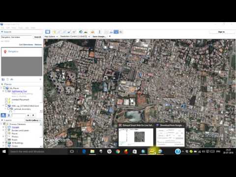
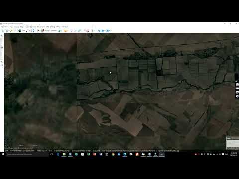
High-resolution satellite images refer to satellite imagery with a high level of detail and clarity. These images are captured by satellites orbiting the Earth and can provide detailed views of the Earth's surface. High-resolution satellite images typically have pixel sizes ranging from a few centimeters to several meters.
Georeferenced satellite images are satellite images that have been processed and adjusted to match specific geographic coordinates on the Earth's surface. This georeferencing process involves assigning a spatial reference system to the satellite image so that it aligns accurately with real-world locations.
_______________
using the QGIS plugins you'll be able to download High-resolution georeferenced images, in this tutorial we've discussed and shown how to download high-resolution georeferenced images in QGIS using one of the powerful plugins in this software.
____________________________________________________________
- QGIS Comprehensive Tutorial for Beginner's - QGIS Full Course
- Sentinel Hub QGIS Plugin - Download Copernicus Satellite imagery (Sentinel 1/2/3/5) in QGIS
- ArcGIS Desktop Complete Beginner's Tutorial - ArcGIS full course
- Download DEMs in QGIS using the open topography plugin (API Key access) for a specified extent
- Creating a web map using qgis2web Plugin in QGIS
____________________________________________________________
🔴 Check it out:
- Like & Share the video with others:
_ _ _ _ _ _ _ _ _ _ _ _ _ _ _ _ _ _ _ _ _ _
- Subscribe to our channel :
=========================================================
#QGIS #GIS #Image #HighResolutionimages #georeferenced
 0:08:04
Download very high-resolution georeferenced satellite images in QGIS
 0:18:42
Download Very High Resolution Georeferenced Satellite Image
 0:03:14
Download High Resolution Georeferenced Satellite Imagery
 0:05:18
RS & GIS QA25 Download very high resolution georeferenced satellite imagery using QGIS
 0:06:06
Download very high resolution georeferenced satellite images in QGIS
 0:09:50
How To Download Very High Quality Georeferenced Satellite Imagery From SAS Planet||Quick & Easy...
 0:02:59
How to download high resolution georeferenced satellite images
 0:00:58
Download 0.5m High-Resolution Georeferenced Google Satellite Images for Free in QGIS | @GISSchools
 0:17:06
How to Download a Very High Resolution Georeferenced Satellite Image
 0:06:45
🛑How to download High-resolution (0.3m) MAXAR satellite image for free, From OpenAreialMap & use...
 0:19:13
Download Very High Resolution Georeferenced Satellite Image using Elshayal Smart GIS
 0:05:06
Download high resolution satellite image using QGIS
 0:08:17
How to download 0.5m High-resolution Georeferenced Google Earth Satellite Images for free In Qgis
 0:07:24
Download very high resolution satellite image 0.3 meter
 0:11:16
How to Download High-Resolution Satellite Images Using QGIS Plugin: A Comprehensive Guide
 0:02:09
Download Very High Resolution Google Earth Pro Images Free
 0:08:14
Trick to download Google earth image and georeference it
 0:08:45
Download very High Resolution & Historical satellite images from Google Earth Pro
 0:08:40
Download Very High Resolution Google Earth Image//Georeferencing in ArcGIS
 0:14:35
QGIS Lesson-8 Download Very High Resolution Georeferenced Google Earth image using smart gis
 0:02:11
Download free 5m very high-resolution satellite imagery - Mapping in GIS
 0:00:16
Easiest way to download high resolution ( 15 cm ) satellite imagery
 0:05:18
how to download High resolution Sentinel 2 satellite image for free from Copernicus hup
 0:02:07
Download high resolution satellite images using QGIS
Комментарии