filmov
tv
Understanding Topographic Maps
Показать описание
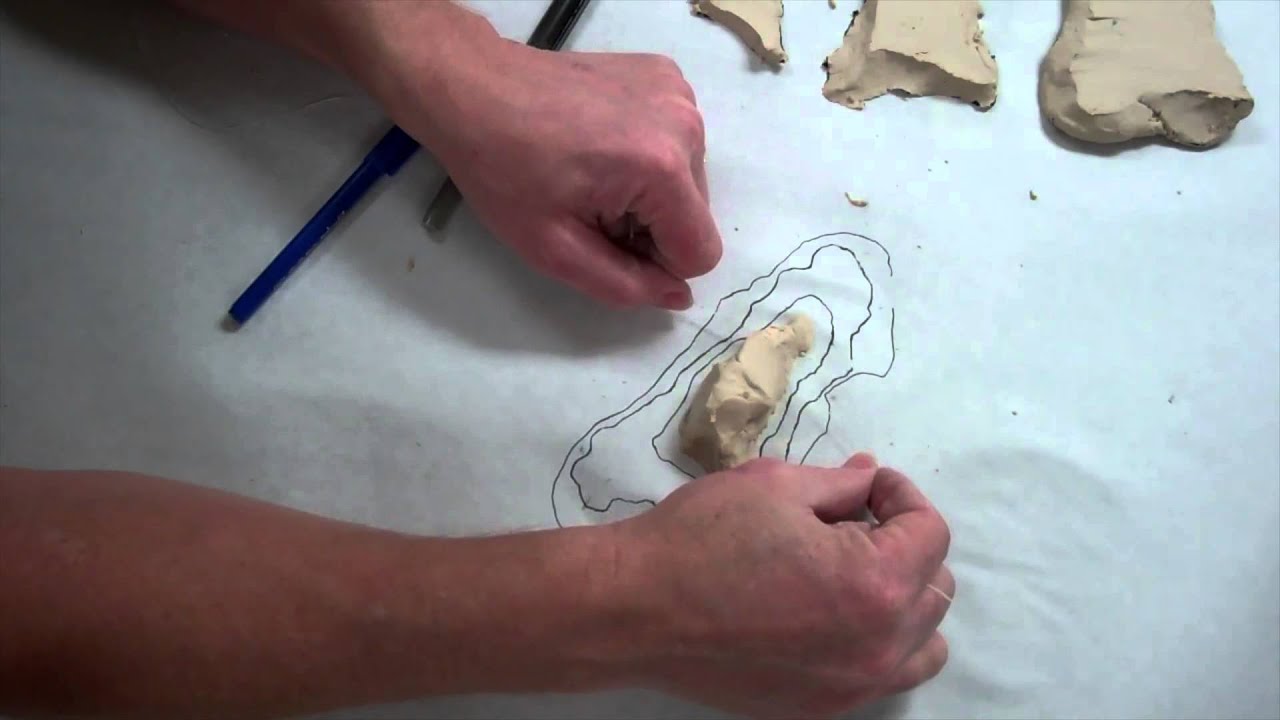
In this video we begin by looking at a topographic map of Pikes Peak in Colorado. I then build a clay model of a mountain and create cross sections representing different elevation layers. Using these layers we trace out the contour lines of the mountain to show how a three dimensional image of a landform can be mapped out on a topographic map.
 0:03:48
How to Read a Topo Map
 0:15:01
Introduction to Topographic Maps
 0:10:06
Understanding Topographic Maps
 0:03:53
How To Read Topographic Maps
 0:28:14
HOW TO READ TOPOGRAPHIC MAPS // Basic Land Navigation Part 1
 0:14:12
Contour Map / Topographic Map Reading
 0:08:52
Topographic Maps - Earth Science for Kids!
 0:05:22
Beginner's Guide to Reading Topographic Maps
 0:43:33
🔴 SSC CGL Mains 2024 | Geography | Class 03 | Most Expected Question | By Taruna Ma'am
 0:14:08
How to Identify Key Terrain Features For Whitetails on a Topographical Map
 0:01:15
Understanding contour lines with Steve Backshall and Ordnance Survey
 0:06:32
What is a Contour (Topographic) Map?
 0:26:46
Master Topography for Hunting | SEE How to Read a Topo Map in 20 Minutes!
 0:05:45
Understanding Topographic Maps - A HUNT! Middle Grade Science Video with Untamed Science
 0:09:35
Understanding Topographic Maps
 0:00:07
Contour Map
 0:06:20
How the World Map Looks Wildly Different Than You Think
 0:00:21
Topo Map Reading Intro: Learn how to read topographic maps in 10 sessions #topography #usgs #hiking
 0:18:59
How To Read a Topographic Map
 0:17:28
Full Toposheet in One Shot😱|Class 10 ICSE|geography
 0:13:08
How to Read a Topo Map | Outside Watch
 0:05:09
Topographic Maps in the Real World | Geography | ClickView
 0:26:05
Complete Guide to Topo Maps | Top 7 Structures for Bass Fishing
 0:10:58
Topographic Maps, Contour Lines, and Contour Intervals
Комментарии