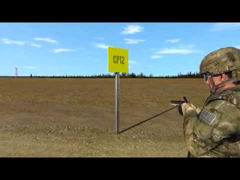
Resection / Land Navigation Techniques

preview_player
Показать описание
How to determine your location when it’s unknown using natural or man made features you can identify on the map. Resection is a navigational tool that when used properly can aid in determining your exact location.
Рекомендации по теме
Комментарии
Автор

This is so much more concise and clear than 99% of land nav tutorials. Thank you for producing this.

roberth
Автор

As a former 2nd Lieutenant I can positively identify that I will still get lost and need First Sergeant to come get me.

dadasaurusrex
Автор

The full video of this was clear and concise training, just brilliant. Thanks for this reminder.

memathews
Автор

Strokermatik makesssome of the best land nav vids, im not great at it but i understand your breakdowns better than any other channel thank you

brianfitzgerald
Автор

Thought that island looked familiar then I saw the map. Solo Point is an awesome ruck and run location. Excellent video! You squeezed a topic many struggle with into an easy and comprehensible short video. Weep done!.

ndf-crps
Автор

You have one of the best channels! Thanks for all you do.

livingfree
Автор

Holy shit! This makes soo much more sense now. So many videos talk about the mechanics, but not about what to do once you've got the number. THANK YOU!

shatzofhudson
Автор

This is exactly the kind of thing I want to learn this is awesome stuff! Thanks stokermatic!

Attemptedvelocity
Автор

You don’t even need the second bearing, you can see where that line intersects the shoreline, and that is where you are, it is more accurate to get a second bearing. That same principle applies to trails, power lines, and creeks. If you can identify what trail you are on, you only need one bearing.

btratemylegs.
Автор

Good stuff. Brother this is such an important lesson to learn for people

Edcpatrol
Автор

thankyou so much! now azimuth makes sense to me!

Yafale
Автор

Hey, "good job" - it is much like when one might be flying VFR using ground-based navaids - tune-in one, draw a line from that navaid - do the same for the second one - where the lines intersect is your position (triangulation). (Of course, after 45-years of flying IFR and retiring, it was good to get back to a basic VFR chart with nieces, nephews, and grandchildren).

RobertMack-izyi
Автор

in surveying we call this bearing intersect or dual azimuth resection

caseyharris
Автор

I went to a military academy and there they conducted land navigation as part of what they called their military science and it was a 4-month-long class that I can guarantee nobody remembers but I distinctly remember the number two Dixon Ticonderoga pencil the Sun toe linsatic compas topographical map(s) The and like 99% of the people not being able to do basic math including our LT

BigTdoubleog
Автор

Hey Stoke!

Great Video like always! I see this is a JBLM Map. Do you recommend any websites or companies that can produce topographical maps of an area of my choosing?

jaygrant
Автор

When sighting with a lensatic compass, make sure the wire is vertical. This is also what the manual of your compass says. You're making your life hard by closing the cap in such a manner.

CristiNeagu
Автор

You only needed the first azmuth since you know you're standing on the shore

mortsdans
Автор

So for converting to a grid azmiuth an I just subtracting 9 each time?

Thedarcyboys
Автор

Where can somebody get these maps btw, does it exist for every area in the world?

gto
Автор

hello friend! you dont need a second point to aim at, in this case! you are on the coastline, so the line you drew on the map will only meet the coastline once, there is the point you actually are!

Randomname
welcome to shbcf.ru