filmov
tv
Malaysia to continue oil, gas exploration in South China Sea despite Beijing's objections: Anwar

Показать описание
Malaysian state energy firm Petronas will continue its oil and gas exploration activities in the South China Sea. Opposition lawmakers had sought clarifications from Prime Minister Anwar Ibrahim, after a leaked note reportedly showed Beijing asking Malaysia to halt its oil and gas exploration in the Kasawari gas field. Discovered in 2011, the Kasawari field is about 200km off the coast of Sarawak, not far from the disputed Luconia Shoals. Its estimated to contain 3.2 trillion cubic feet of natural gas. Mr Anwar said Kasawari is located within Malaysia's exclusive economic zone. Melissa Goh reports.
 0:02:53
Malaysia to continue oil, gas exploration in South China Sea despite Beijing's objections: Anwa...
 0:01:00
MARKET PULSE AM OCT 16, 2024
 0:01:07
AWANI Tonight: Malaysia to continue oil exploration despite China’s protests
 0:05:07
Tension Soars After China Orders Malaysia to Stop Oil Exploration | Latest English News | WION
 0:16:05
Oil & Gas bad = Malaysia GDP down?
 0:10:21
Malaysia risks being net importer of oil, gas without energy transition: Economy minister
 0:01:41
China-Malaysia Tension Over Oil Fields | Latest News | WION
 0:04:46
Malaysia Challenges Aggressive China in Sea Oil Exploration | GRAVITAS
 0:06:28
MARKET MATTERS: China, Oil Continues Pressure on Malaysia
 0:01:18
SME News | Malaysia to benefit from higher oil, gas prices
 0:01:30
Malaysia stands by its claim on oil and gas in its waters, but open to talks with China, says Anwar
 0:01:13
Petronas CEO defends right to conduct exploration within Malaysia's sovereign waters
 0:17:15
Oil and Gas Sector Outlook for Bursa Malaysia Q4/Q1 2020
 0:03:48
Carpio cites Malaysia, Indonesia going ahead with oil exploration despite China threats
 0:08:18
How Important is SABAH to MALAYSIA's ECONOMY?
 0:06:55
TOP 3 Oil & Gas Stocks in Malaysia | BURSA MALAYSIA | How to Invest in Stocks
 0:06:44
Malaysia faces higher gas imports if it doesn't quickly switch to sustainable energy - Rafizi
 0:01:23
Malaysia Rejects China's Warnings: Oil & Gas Exploration Continues in Disputed Waters
 0:10:16
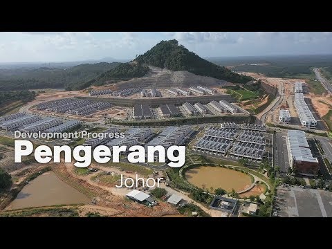
PENGERANG Oil and Gas Industries Development, Johor, Malaysia
 0:30:28
S3E3 : The Road Trip Continues! Land Cruiser's 1st Mechanical Issue
 0:02:07
Malaysia needs to speed up its renewable energy goals
 0:03:39
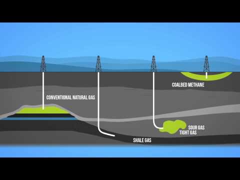
Natural Gas 101
 0:01:52
Malaysia Awards 2021 Oil&Gas/Process Safety - PETRONAS P(T)SB - VGSP Eliminates Liquid
 0:59:20
Learn about Crude Oil & Natural Gas Derivatives. #icicidirect
Комментарии