filmov
tv
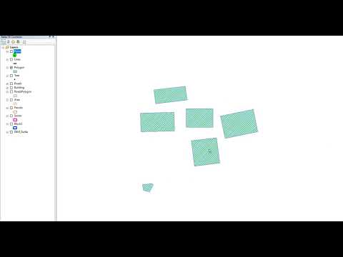
Check Geometry Tool ArcGIS

Показать описание
Check Geometry Tool, Features Toolset, Data Management ArcToolbox
Summary
Generates a report of the geometry problems in a feature class.
Valid input formats are shapefile and feature classes stored in a personal geodatabase or file geodatabase. Enterprise geodatabases automatically check the validity of each geometry when they are uploaded; therefore, the Check Geometry and Repair Geometry tools are not for use with Enterprise geodatabases.
For additional information on geometry problems, its impact on the software, and potential sources, see Checking and repairing geometries.
Usage
The Output Table will have a record for each geometry problem discovered. If no problems are found, the table will be empty.
The Output Table has the following fields:
CLASS—The full path to and name of the feature class in which the problem was found.
FEATURE_ID—The Feature ID (FID) or Object ID (OID) for the feature with the geometry problem.
PROBLEM—A short description of the problem.
The PROBLEM field will contain one of the following:
Short segment—Some segments are shorter than allowed by the system units of the spatial reference associated with the geometry.
Null geometry—The feature has no geometry or nothing in the SHAPE field.
Incorrect ring ordering—The polygon is topologically simple, but its rings may not be oriented correctly (outer rings clockwise; inner rings counterclockwise).
Incorrect segment orientation—Individual segments are not consistently oriented. The to point of segment i should be incident on the from point of segment i+1.
Self intersections—A polygon must not intersect itself.
Unclosed rings—The last segment in a ring must have its to point incident on the from point of the first segment.
Empty parts—The geometry has multiple parts and one of them is empty (has no geometry).
Duplicate vertex—The geometry has two or more vertices with identical coordinates.
Mismatched attributes—The z- or m-coordinate of a line segment's endpoint does not match the z- or m-coordinate of the coincident endpoint on the next segment.
Discontinuous parts—One of the geometry's parts is made up of disconnected or discontinuous parts.
Empty Z values—The geometry has one or more vertices with an empty z-value (NaN, for example).
Bad envelope—The envelope does not match the coordinate extent of the geometry.
Bad dataset extent—The extent of the dataset does not contain all features.
The problem identified by this tool can be addressed in the following ways:
Manually edit and fix the feature with the geometry problems. Some of the problems cannot be fixed through editing.
Run the Repair Geometry tool on the feature classes that were identified as having geometry problems.
For point features, only the null geometry problem is possible.
To facilitate the review of the features that are reported to have geometry problems, you can join the Input Features to the Output Table using the Add Join tool, along with the input's OBJECTID or FID field and the output table's FEATURE_ID field.
geometry ,calculate geometry ,tools check geometry ,check geometry arcgis ,check geometry arcmap ,arcgis check geometry ,arcgis'te geometri kontrolü (check geometry) ,arcgis geometri kontrolü ,geometry control ,arcgis geometry control ,fix geometry ,arcgis'te geometri düzeltme (repair geometry) ,geometry control in arcgis ,geometry error ,repair geometry ,repair geometry arcgis ,arcgis repair geometry ,repair geometry arcmap ,arcmap repair geometry ,extract geometry
شرح الأداة :
لمتابعة موقع GISforWE من هنا:
موقع لكل مهتم في مجال نظم المعلومات الجغرافية GIS من هنا:
احترف التعامل مع البيانات الجغرافية من خلال برامج ArcGIS:
تعلم اساسيات إنشاء قواعد البيانات الجغرافية من هنا:
اليك صفحه ومجموعة على الفيس بوك لتعلم أكثر بما يخص نظم المعلومات الجغرافية (GIS) و برامج ArcGIS من خلال هذه الروابط:
مجموعة على الفيس بوك ArcGIS :
مجموعة على الفيس بوك GIS for WE - ArcGIS:
صفحة الفيس بوك GIS for WE:
رابط فيديو مقدمة تعلم على برامج ArcGIS بثلاثة مراحل :
#ArcGIS
#Analysis_GIS
#Data_Analysis
اعداد وتقديم المطور والباحث في مجال نظم المعلومات الجغرافية حسام جعبه
رام الله - فلسطين.
#GISforWE
GIS for World of E-Learning
 0:00:38
Check Geometry Tool ArcGIS
 0:01:47
Repair Geometry Tool ArcGIS
 0:11:14
Check and Repair Geometry, ArcGIS Pro
 0:01:14
Calculate Area Disabled [SOLVED] , Calculate Geometry Tool is Disabled, Field Greyed, ArcMap ArcGIS
 0:02:13
Use replace geometry tool in ArcGIS Pro
 0:02:20
Calculate Geometry Disabled (Resolved) in ArcGIS
 0:01:07
Dice Tool ArcGIS
 0:15:15
Calculating Geometry in ArcGIS Pro
 0:02:56
ArcGIS Pro Basics - Calculate Geometry
 0:02:34
Add Geometry Attributes Tool ArcGIS
 0:09:49
Fix Topology Error using ArcGIS
 0:01:22
Using the Replace Geometry Tool in ArcGIS Pro
 0:06:26
How to Validate & Fix Geometry in QGIS
 0:01:44
How to Check Result and Edit tool you runned in ArcMap ll Edit Geoprocessing Option
 0:02:41
ArcGIS Pro - Replace Geometry
 0:03:57
ArcGIS'te Geometri Kontrolü (Check Geometry)
 0:05:19
Editing in ArcGIS Pro - Replace Geometry
 0:02:30
GIS: How to batch Check geometry in ArcGIS for a list of datasets from a CSV? (2 Solutions!!)
 0:00:58
Copy Features Tool ArcGIS
 0:11:30
How to solve Invalid Topology using Repair Geometry tool if your clip is not working
 0:01:54
How To Find Self Overlaps in ArcGIS Pro
 0:01:50
Minimum Bounding Geometry Tool ArcGIS
 0:01:03
ArcGIS Pro - Editing : Replace Geometry
 0:06:55
How to apply Topology on shapefile using arcgis
Комментарии