filmov
tv
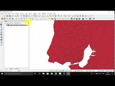
Upload Shapefile in MySQL as Spatial Data | QGIS | FWTools | @GISSchools

Показать описание
In this instructive tutorial, we'll guide you through the process of uploading a Shapefile into MySQL as spatial data using the powerful combination of QGIS and FWTools. Whether you're a GIS professional or a data enthusiast, this video provides valuable insights into harnessing spatial databases for your projects.
🌐 Key Topics Covered:
Understanding the significance of Shapefiles in GIS and spatial data.
Introduction to MySQL as a spatial database solution.
Step-by-step guide on importing Shapefiles into MySQL using QGIS.
Leveraging FWTools to ensure seamless data transformation and compatibility.
Tips and best practices for working with spatial data in a database environment.
🔍 Dive Deeper:
Explore the different spatial database formats, including PostGIS and Spatialite.
Convert Shapefiles to GeoJSON for web-based applications and mapping.
Learn about the advantages of PostgreSQL with PostGIS for advanced spatial capabilities.
Gain insights into the types of spatial databases and their real-world applications.
Discover practical examples of spatial databases in action.
Whether you're building a GIS project, managing geospatial information, or simply expanding your knowledge of spatial databases, this video has something for you.
🔗 Relevant Keywords: shapefile, postgis, shp format, shapefile format, shape file format, esri shape, esri shape file, spatial databases, spatialite, diva gis shapefile, esri shapefile, oracle spatial, shapefile to geojson, postgis download, shapefile download, PostgreSQL postgis, shapefile in GIS, arcgis shapefile, spatial database in DBMS, postgres geospatial, spatial DBMS, spatial DB, types of spatial database, shp python, arcgis SHP, SHP GIS, geojson shapefile, example of spatial database, installing postgis, spatial databases examples, shapefiles to geojson, PostgreSQL and postgis, spatial data database.
Don't miss out on this opportunity to enhance your spatial data management skills. Watch the video, subscribe to our channel, and stay updated with the latest GIS and spatial database tutorials.
------------------------------------------
------Searching Topics:-------
------------------------------------------
MySQL Workbench 8 x - The Load Spatial Data Tool,
import and export shapefiles in database,
Import Shapefile from QGIS into MySQL using WKT ,
MySQL 8 x Spatial Data,
Import Shapefile from QGIS into MySQL using WKT,
How to Create Spatial Databases in PostGIS PostgreSQL Import Shapefile into the DB,
MySQL 8 - How do I create Spatial Tables with the Workbench,
How to creat database and import shapefile,
Upload Shapefile in MySQL as Spatial Data QGIS FWTools GIS amp IT Tools,
MySQL Workbench 8 x - Load Spatial Data tool and solving issue with CRS string line,
Import Shapefile from QGIS into MySQL using WKT,
MySQL Workbench 8 x - The Load Spatial Data Tool,
Upload Shapefile kedalam WebGIS Leaflet js Menggunakan Database MySQL-QGIS-GeoServer,
import and export shapefiles in database,
QGIS 2 18 x - How to import a shapefile to MySQL only using the Copy amp Paste command in Map Canvas,
------------------------------------------
----------Contact Me:------------
------------------------------------------
 0:08:56
 0:06:57
 0:01:05
![[Mysql] Tutorial 276](https://i.ytimg.com/vi/eH-4-wzZlOg/hqdefault.jpg) 0:01:52
0:01:52
 0:09:34
 0:05:31
 0:04:32
 0:01:39
 0:05:43
 0:04:44
 0:06:57
 0:26:15
 0:10:40
 0:12:35
 0:03:07
 0:04:41
 0:01:32
 0:09:24
 0:04:55
 0:14:16
 0:01:46
 0:01:15
 0:03:51
 0:06:34