filmov
tv
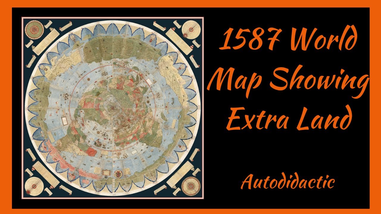
1587 World Map Showing Extra Land
Показать описание
Help Support This Channel
Donations
Patreon
👕 Get Your Autodidactic Merch Here 🧢
There are two links, one for northern hemisphere and one for southern.
All merch is the same this is just to save you money on postage.
USA, UK, Canada and rest of world -
Australia, New Zealand and S.E. Asia –
Protect Yourself
Get VirtualShield Here and protect your computer and phone from prying eyes from $3 a month
Get Out Of The Fiat Money System With Crypto-Currency.
Join my email list
🔗 Social Media
Instagram
Facebook –
My other Youtube Channel, All About Bringing Out Your Potential And Building A Life You Love
My Back-up Channels
Bitchute
Music used in video
Russian Throat Singing
➡️ Please Like - Comment - Subscribe and Share ⬅️
Links
David Rumsey site
1563 Map
Donations
Patreon
👕 Get Your Autodidactic Merch Here 🧢
There are two links, one for northern hemisphere and one for southern.
All merch is the same this is just to save you money on postage.
USA, UK, Canada and rest of world -
Australia, New Zealand and S.E. Asia –
Protect Yourself
Get VirtualShield Here and protect your computer and phone from prying eyes from $3 a month
Get Out Of The Fiat Money System With Crypto-Currency.
Join my email list
🔗 Social Media
Facebook –
My other Youtube Channel, All About Bringing Out Your Potential And Building A Life You Love
My Back-up Channels
Bitchute
Music used in video
Russian Throat Singing
➡️ Please Like - Comment - Subscribe and Share ⬅️
Links
David Rumsey site
1563 Map
 0:29:04
1587 World Map Showing Extra Land
 0:06:20
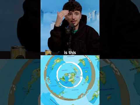
How the World Map Looks Wildly Different Than You Think
 0:03:52
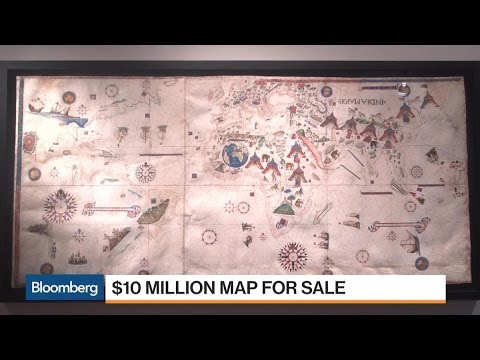
Why This Map Could Be Worth $10 Million
 0:06:00
Why all world maps are wrong
 0:02:01
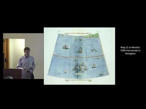
Largest Early World Map - Monte's 10 ft. Planisphere of 1587
 0:07:41
Why the North Pole looked like this on Old Maps
 0:48:36
Talk with Chet Van Duzer: New Research on Urbano Monte's 1587 World Map | Feb 13, 2019
 0:00:32
The edge of the earth REVEALED
 0:02:33
Largest Early World Map - Monte's 10 ft. Planisphere of 1587 in Google Earth
 0:12:15
The Mysterious Land That Kept the World From Tipping Over (Terra Australis Pt. 1)
 0:00:47
How The US Map Has Changed In 200 Years
 1:01:19
Frames That Speak: An Introduction to Cartographic Cartouches
 0:00:54
Exploring Historic Maps: Hereford Mappa Mundi
 0:00:52
Exploring Historic Maps: The Catalan Atlas
 0:56:40
Brent Lane on John White's 1585 Map of North Carolina Outer Banks
 0:00:57
#1507 #map of #anchorage #alaska #USA #america #urban #Monte #historical #world #detailed #2023
 0:00:17
Burgman 😱modified 👍
 0:06:35
How Ice Ages Happen: The Milankovitch Cycles
 0:38:38
Chet Van Duzer on the Martellus Map - Mondays at Beinecke, October 3, 2022
 0:31:17
Origins of Regions - Toponyms | Map Room Ramblings #12 | Atlas Altera
 0:43:29
David Rumsey Map Center: Dedication and Opening
 0:11:51
Proving The World is Flat!
 0:00:48
Exploring Historic Maps: Ptolemy's World Map
 0:24:09
THE LIFE OF ELIZABETH I, pt 5 | Heart and stomach of a King. Tudor Monarchs’ Series. History Calling...
Комментарии