filmov
tv
Animation in ArcGIS Pro – Adding Text and Images
Показать описание
After you have authored some animation, you can add text and images. Text and images are a way to enhance any map to help your viewers understand the message your map is conveying.
Text and images can help detail research or tell a story:
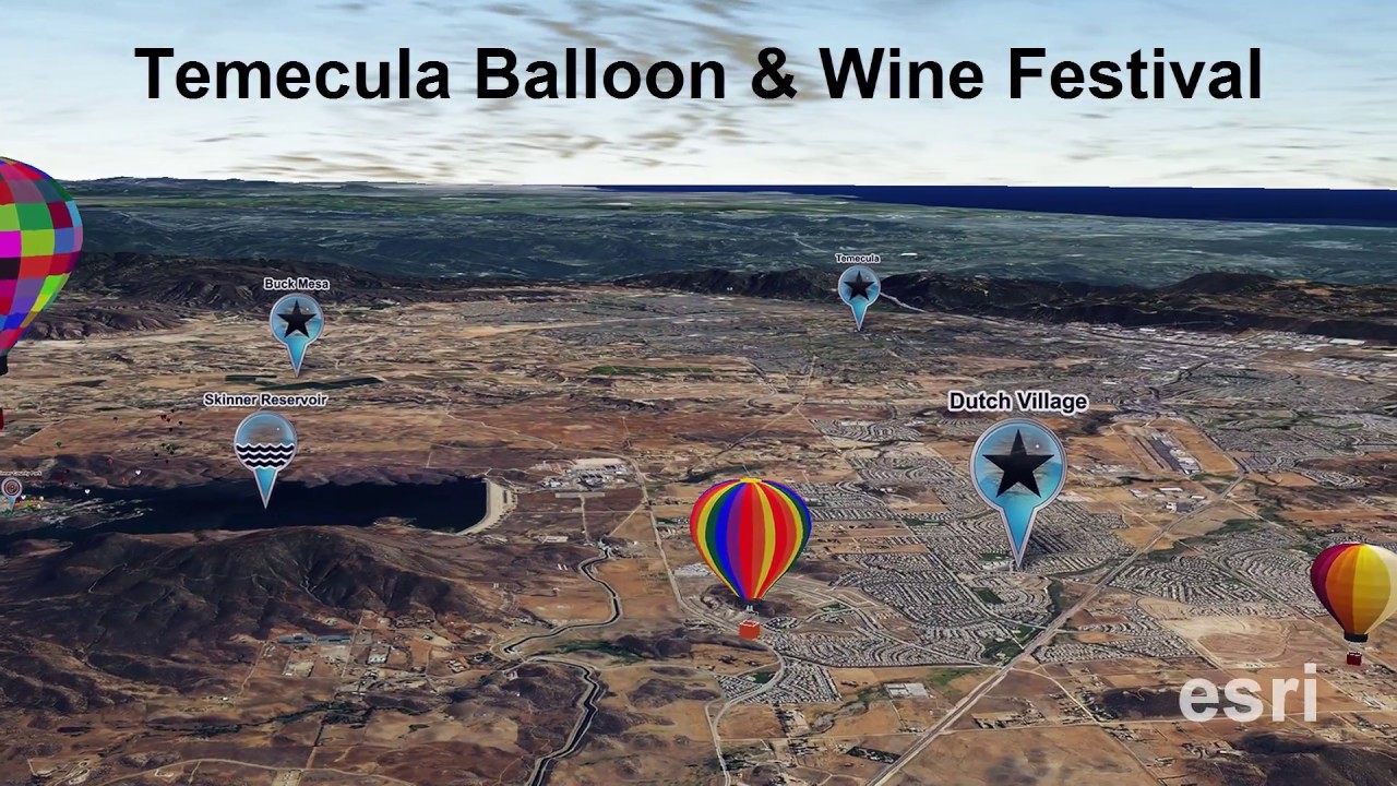
• Such as describing the Deepwater Horizon oil spill zone.
• Create a narrative to show the environmental impact from
climbers on Mount Everest.
• Or enhance a map of a festival with logos and informative
titling.
There is no need to use outside media editing packages to add these elements. Text and images can be added right in ArcGIS Pro.
Text and images can help detail research or tell a story:
• Such as describing the Deepwater Horizon oil spill zone.
• Create a narrative to show the environmental impact from
climbers on Mount Everest.
• Or enhance a map of a festival with logos and informative
titling.
There is no need to use outside media editing packages to add these elements. Text and images can be added right in ArcGIS Pro.
 0:09:00
ArcGIS Pro Animation Overview
 0:01:56
Animation in ArcGIS Pro – Create Animation from Bookmarks
 0:16:12
Animate Your Maps with ArcGIS Pro
 0:08:26
How to use Animation tool in ArcGIS Pro
 0:00:52
Animate 3D fly throughs with ArcGIS Pro
 0:00:31
ArcGIS Pro Animations Example
 0:01:15
ArcGIS Pro Animation Montage
 0:02:41
Animation in ArcGIS Pro – Animating Linear Paths
 0:20:49
How to Make Time Series Animation in ArcGIS Pro | Earthquake Time Series Map
 0:00:30
ArcGIS Pro Route Animation - Trail run
 0:01:26
Animation Lessons—Layer Visibility
 0:00:16
2D animation in ArcGIS Pro
 0:00:17
3D animation in ArcGIS Pro
 0:03:34
Animation in ArcGIS Pro – Adding Text and Images
 0:01:48
ArcGIS Pro Animations
 0:01:02
Millennium Force Coaster Animation with ArcGIS Pro 1.2
 0:00:13
Shipping routes in 1770 - ArcGIS Pro animation exercise
 0:06:36
Animation in ArcGIS Pro
 0:01:28
Time Enabled Animation in ArcGIS Pro v 1.3
 0:06:40
ArcGIS Pro 3D animation
 0:00:16
Animation in ArcGIS Pro
 0:00:25
ArcGIS PRO Animation Application
 0:04:44
Animation in ArcGIS Pro – Fixing Animation Overshoot
 0:00:34
Season 1 Animation with ArcGIS pro episode 1- Saudi Arabia
Комментарии